You are here: Home > Network List > GS - US Geological Survey Networks Stations List
> Station KAN10 Keim Farm > Earthquake Result Viewer
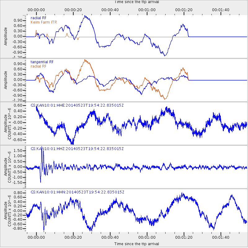
KAN10 Keim Farm - Earthquake Result Viewer
*The percent match for this event was below the threshold and hence no stack was calculated.
| Earthquake location: |
East Of Lake Baykal, Russia |
| Earthquake latitude/longitude: |
56.1/114.0 |
| Earthquake time(UTC): |
2014/05/23 (143) 19:42:28 GMT |
| Earthquake Depth: |
10 km |
| Earthquake Magnitude: |
5.6 MB |
| Earthquake Catalog/Contributor: |
NEIC PDE/NEIC COMCAT |
|
| Network: |
GS US Geological Survey Networks |
| Station: |
KAN10 Keim Farm |
| Lat/Lon: |
37.12 N/98.10 W |
| Elevation: |
417 m |
|
| Distance: |
83.2 deg |
| Az: |
25.317 deg |
| Baz: |
342.575 deg |
| Ray Param: |
$rayparam |
*The percent match for this event was below the threshold and hence was not used in the summary stack. |
|
| Radial Match: |
61.137825 % |
| Radial Bump: |
400 |
| Transverse Match: |
39.61178 % |
| Transverse Bump: |
400 |
| SOD ConfigId: |
3390531 |
| Insert Time: |
2019-04-12 00:11:24.306 +0000 |
| GWidth: |
2.5 |
| Max Bumps: |
400 |
| Tol: |
0.001 |
|
Signal To Noise
| Channel | StoN | STA | LTA |
| GS:KAN10:01:HHZ:20140523T19:54:22.835015Z | 7.7380285 | 6.548981E-7 | 8.463371E-8 |
| GS:KAN10:01:HHN:20140523T19:54:22.835015Z | 0.81939167 | 3.525699E-7 | 4.302825E-7 |
| GS:KAN10:01:HHE:20140523T19:54:22.835015Z | 1.4216163 | 4.1654658E-7 | 2.9300915E-7 |
| Arrivals |
| Ps | |
| PpPs | |
| PsPs/PpSs | |


