MUR Murrieta - Earthquake Result Viewer
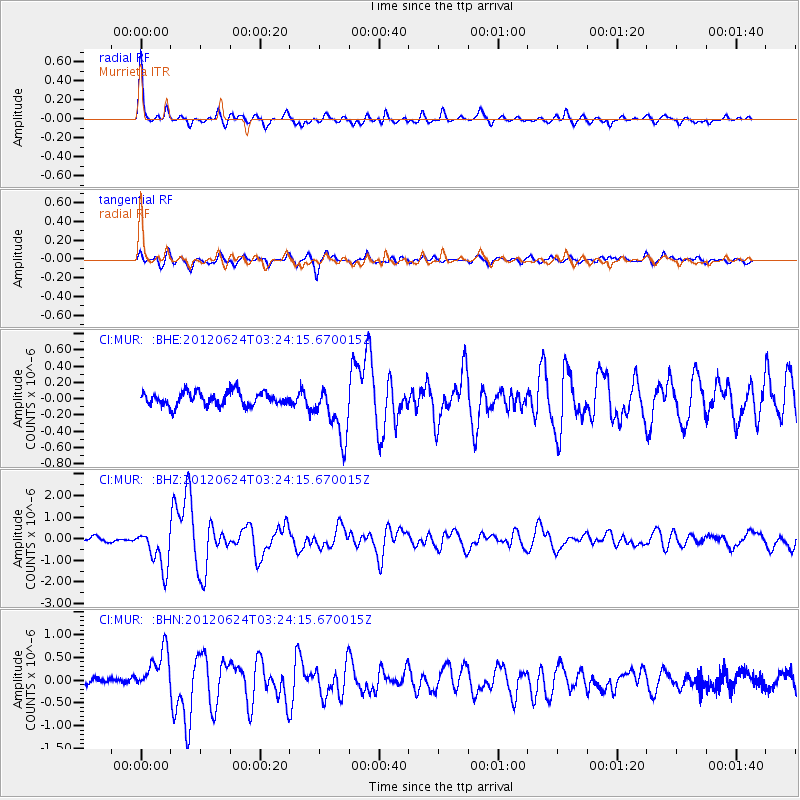
Earthquake location: Near East Coast Of Kamchatka
Earthquake latitude/longitude: 57.6/163.2
Earthquake time(UTC): 2012/06/24 (176) 03:15:01 GMT
Earthquake Depth: 10 km
Earthquake Magnitude: 5.8 MB, 5.8 MS, 6.0 MW, 6.1 MW
Earthquake Catalog/Contributor: WHDF/NEIC
Network: CI Caltech Regional Seismic Network
Station: MUR Murrieta
Lat/Lon: 33.60 N/117.20 W
Elevation: 562 m
Distance: 57.0 deg
Az: 78.321 deg
Baz: 320.825 deg
Ray Param: 0.0637992
Estimated Moho Depth: 41.75 km
Estimated Crust Vp/Vs: 1.63
Assumed Crust Vp: 6.264 km/s
Estimated Crust Vs: 3.843 km/s
Estimated Crust Poisson's Ratio: 0.20
Radial Match: 91.73008 %
Radial Bump: 398
Transverse Match: 80.42588 %
Transverse Bump: 400
SOD ConfigId: 462790
Insert Time: 2013-02-12 17:15:55.808 +0000
GWidth: 2.5
Max Bumps: 400
Tol: 0.001

Signal To Noise

ChannelStoNSTALTA
CI:MUR: :BHZ:20120624T03:24:15.670015Z7.2951559.426662E-71.2921811E-7
CI:MUR: :BHN:20120624T03:24:15.670015Z4.2083774.862678E-71.1554759E-7
CI:MUR: :BHE:20120624T03:24:15.670015Z3.97817423.372119E-78.4765496E-8
Arrivals
Ps4.4 SECOND
PpPs17 SECOND
PsPs/PpSs21 SECOND