
UTMT Martin, TN - Earthquake Result Viewer
| ||||||||||||||||||
| ||||||||||||||||||
| ||||||||||||||||||
|
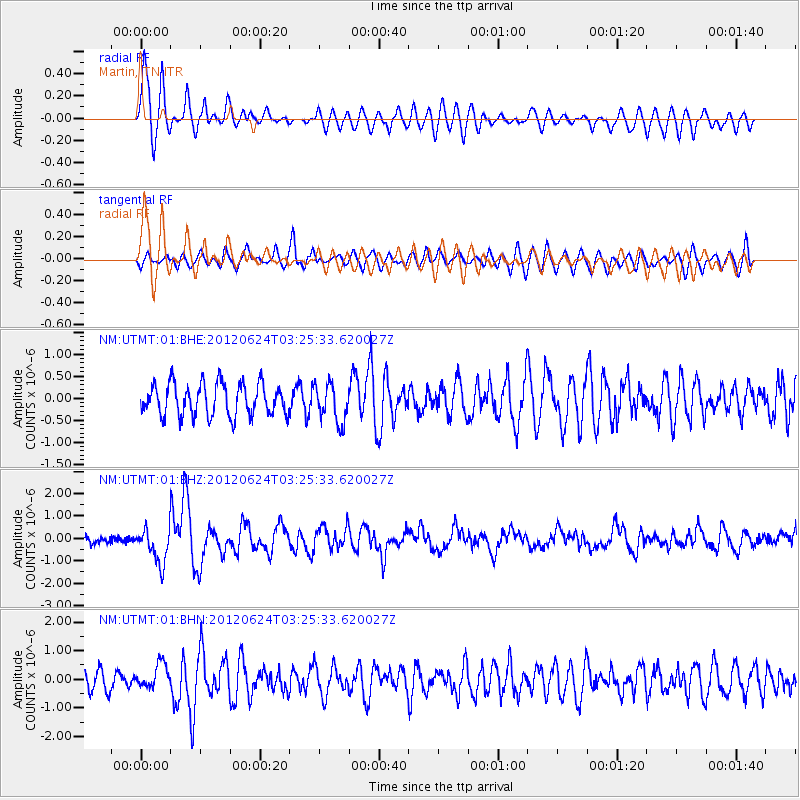
Signal To Noise
| Channel | StoN | STA | LTA |
| NM:UTMT:01:BHZ:20120624T03:25:33.620027Z | 5.584364 | 7.870897E-7 | 1.4094528E-7 |
| NM:UTMT:01:BHN:20120624T03:25:33.620027Z | 1.2771721 | 4.266931E-7 | 3.3409208E-7 |
| NM:UTMT:01:BHE:20120624T03:25:33.620027Z | 1.2149576 | 4.4070563E-7 | 3.6273337E-7 |
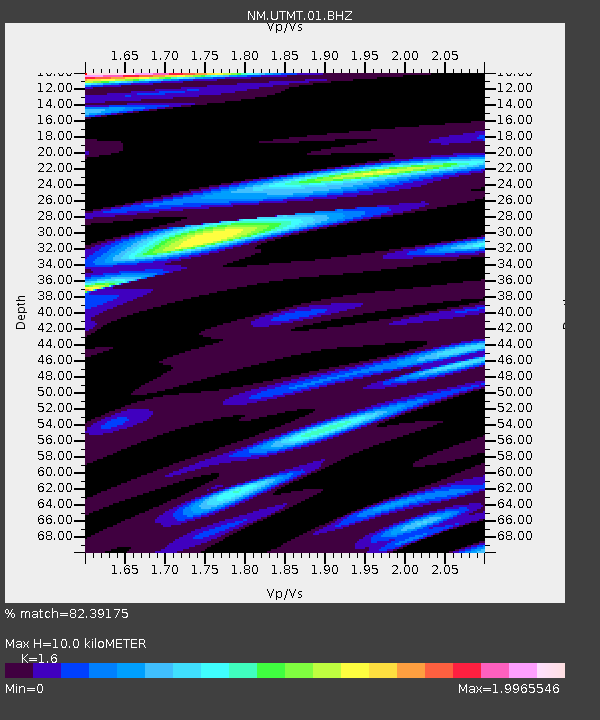
| Arrivals | |
| Ps | 1.0 SECOND |
| PpPs | 3.9 SECOND |
| PsPs/PpSs | 4.8 SECOND |

