You are here: Home > Network List > TA - USArray Transportable Network (new EarthScope stations) Stations List
> Station H37A Dierke Farm, Cannon Falls, MN, USA > Earthquake Result Viewer
H37A Dierke Farm, Cannon Falls, MN, USA - Earthquake Result Viewer

| Earthquake location: |
Near East Coast Of Kamchatka |
| Earthquake latitude/longitude: |
57.6/163.2 |
| Earthquake time(UTC): |
2012/06/24 (176) 03:15:01 GMT |
| Earthquake Depth: |
10 km |
| Earthquake Magnitude: |
5.8 MB, 5.8 MS, 6.0 MW, 6.1 MW |
| Earthquake Catalog/Contributor: |
WHDF/NEIC |
|
| Network: |
TA USArray Transportable Network (new EarthScope stations) |
| Station: |
H37A Dierke Farm, Cannon Falls, MN, USA |
| Lat/Lon: |
44.58 N/92.92 W |
| Elevation: |
321 m |
|
| Distance: |
60.2 deg |
| Az: |
53.085 deg |
| Baz: |
322.961 deg |
| Ray Param: |
0.061697416 |
| Estimated Moho Depth: |
10.0 km |
| Estimated Crust Vp/Vs: |
1.74 |
| Assumed Crust Vp: |
6.571 km/s |
| Estimated Crust Vs: |
3.782 km/s |
| Estimated Crust Poisson's Ratio: |
0.25 |
|
| Radial Match: |
92.65354 % |
| Radial Bump: |
389 |
| Transverse Match: |
82.413246 % |
| Transverse Bump: |
400 |
| SOD ConfigId: |
462790 |
| Insert Time: |
2013-02-12 17:46:30.454 +0000 |
| GWidth: |
2.5 |
| Max Bumps: |
400 |
| Tol: |
0.001 |
|
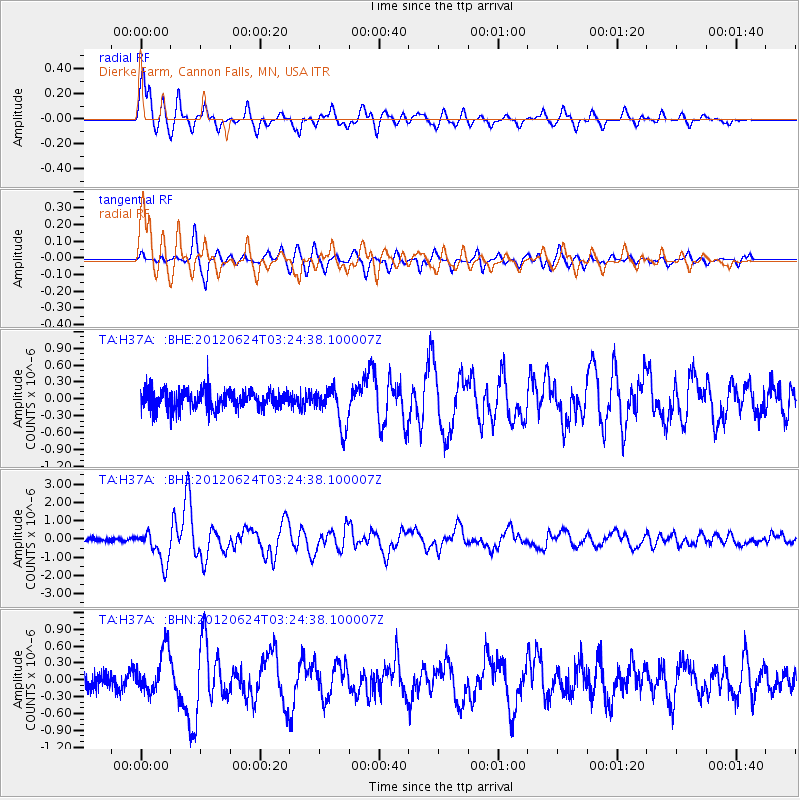
Signal To Noise
| Channel | StoN | STA | LTA |
| TA:H37A: :BHZ:20120624T03:24:38.100007Z | 7.905995 | 8.950142E-7 | 1.1320703E-7 |
| TA:H37A: :BHN:20120624T03:24:38.100007Z | 2.4499278 | 3.7124596E-7 | 1.5153341E-7 |
| TA:H37A: :BHE:20120624T03:24:38.100007Z | 2.2620928 | 3.4655247E-7 | 1.5319993E-7 |
| Arrivals |
| Ps | 1.2 SECOND |
| PpPs | 4.0 SECOND |
| PsPs/PpSs | 5.1 SECOND |


