You are here: Home > Network List > TA - USArray Transportable Network (new EarthScope stations) Stations List
> Station X44A Crenshaw, MS, USA > Earthquake Result Viewer
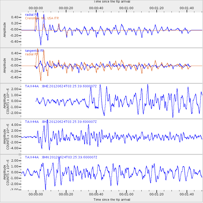
X44A Crenshaw, MS, USA - Earthquake Result Viewer
*The percent match for this event was below the threshold and hence no stack was calculated.
| Earthquake location: |
Near East Coast Of Kamchatka |
| Earthquake latitude/longitude: |
57.6/163.2 |
| Earthquake time(UTC): |
2012/06/24 (176) 03:15:01 GMT |
| Earthquake Depth: |
10 km |
| Earthquake Magnitude: |
5.8 MB, 5.8 MS, 6.0 MW, 6.1 MW |
| Earthquake Catalog/Contributor: |
WHDF/NEIC |
|
| Network: |
TA USArray Transportable Network (new EarthScope stations) |
| Station: |
X44A Crenshaw, MS, USA |
| Lat/Lon: |
34.50 N/90.15 W |
| Elevation: |
109 m |
|
| Distance: |
69.7 deg |
| Az: |
57.552 deg |
| Baz: |
326.626 deg |
| Ray Param: |
$rayparam |
*The percent match for this event was below the threshold and hence was not used in the summary stack. |
|
| Radial Match: |
90.761055 % |
| Radial Bump: |
366 |
| Transverse Match: |
76.09477 % |
| Transverse Bump: |
338 |
| SOD ConfigId: |
462790 |
| Insert Time: |
2013-02-12 18:04:31.551 +0000 |
| GWidth: |
2.5 |
| Max Bumps: |
400 |
| Tol: |
0.001 |
|
Signal To Noise
| Channel | StoN | STA | LTA |
| TA:X44A: :BHZ:20120624T03:25:39.600007Z | 13.28418 | 1.5422052E-6 | 1.1609337E-7 |
| TA:X44A: :BHN:20120624T03:25:39.600007Z | 2.7524638 | 7.7107734E-7 | 2.8014077E-7 |
| TA:X44A: :BHE:20120624T03:25:39.600007Z | 1.549035 | 4.9476995E-7 | 3.1940527E-7 |
| Arrivals |
| Ps | |
| PpPs | |
| PsPs/PpSs | |


