You are here: Home > Network List > AZ - ANZA Regional Network Stations List
> Station FRD AZ.FRD > Earthquake Result Viewer
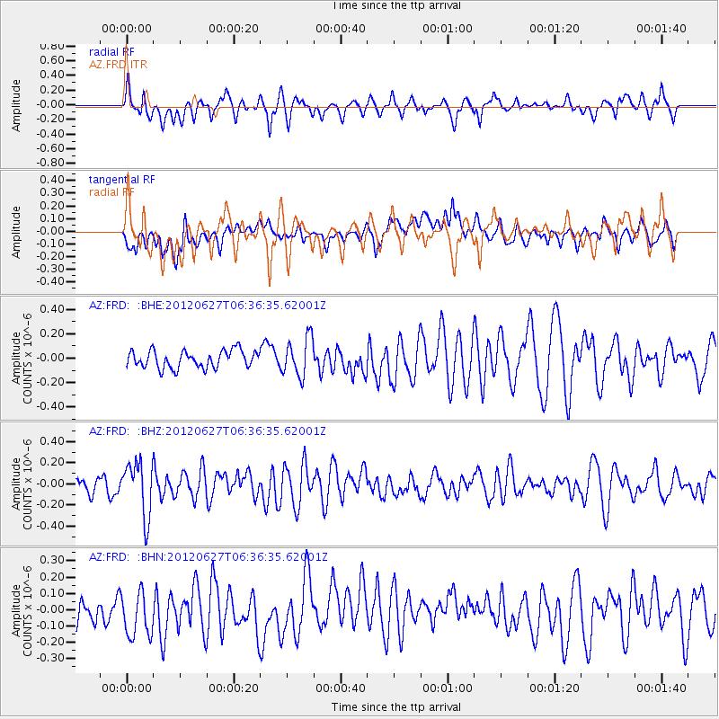
FRD AZ.FRD - Earthquake Result Viewer
*The percent match for this event was below the threshold and hence no stack was calculated.
| Earthquake location: |
El Salvador |
| Earthquake latitude/longitude: |
13.8/-90.0 |
| Earthquake time(UTC): |
2012/06/27 (179) 06:30:59 GMT |
| Earthquake Depth: |
133 km |
| Earthquake Magnitude: |
5.7 MW, 5.4 MB, 5.7 MW |
| Earthquake Catalog/Contributor: |
WHDF/NEIC |
|
| Network: |
AZ ANZA Regional Network |
| Station: |
FRD AZ.FRD |
| Lat/Lon: |
33.49 N/116.60 W |
| Elevation: |
1164 m |
|
| Distance: |
31.1 deg |
| Az: |
313.546 deg |
| Baz: |
122.59 deg |
| Ray Param: |
$rayparam |
*The percent match for this event was below the threshold and hence was not used in the summary stack. |
|
| Radial Match: |
67.9779 % |
| Radial Bump: |
400 |
| Transverse Match: |
59.02541 % |
| Transverse Bump: |
400 |
| SOD ConfigId: |
463687 |
| Insert Time: |
2013-02-20 16:16:48.441 +0000 |
| GWidth: |
2.5 |
| Max Bumps: |
400 |
| Tol: |
0.001 |
|
Signal To Noise
| Channel | StoN | STA | LTA |
| AZ:FRD: :BHZ:20120627T06:36:35.62001Z | 1.7424976 | 2.5774276E-7 | 1.4791571E-7 |
| AZ:FRD: :BHN:20120627T06:36:35.62001Z | 1.075542 | 1.5235638E-7 | 1.4165545E-7 |
| AZ:FRD: :BHE:20120627T06:36:35.62001Z | 2.2354035 | 1.5823515E-7 | 7.0785944E-8 |
| Arrivals |
| Ps | |
| PpPs | |
| PsPs/PpSs | |


