You are here: Home > Network List > AZ - ANZA Regional Network Stations List
> Station SMER AZ.SMER > Earthquake Result Viewer
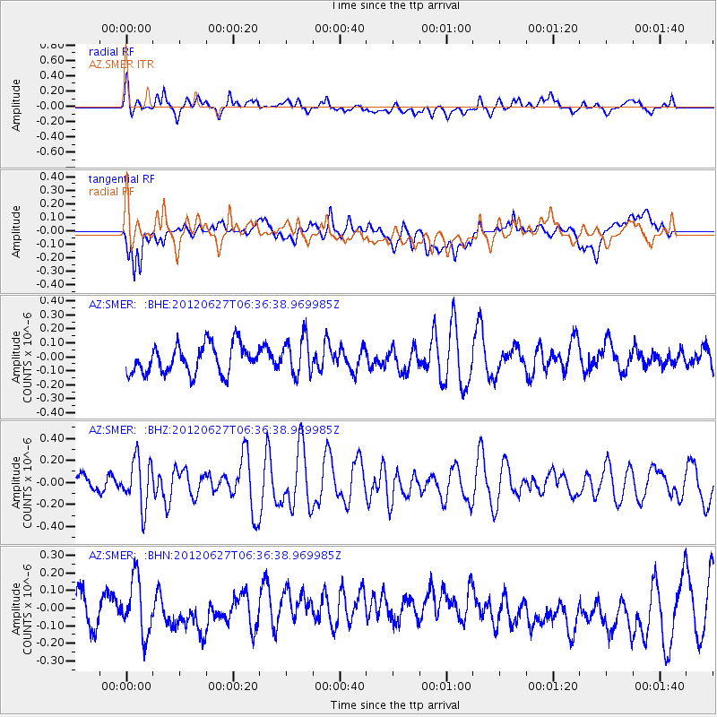
SMER AZ.SMER - Earthquake Result Viewer
*The percent match for this event was below the threshold and hence no stack was calculated.
| Earthquake location: |
El Salvador |
| Earthquake latitude/longitude: |
13.8/-90.0 |
| Earthquake time(UTC): |
2012/06/27 (179) 06:30:59 GMT |
| Earthquake Depth: |
133 km |
| Earthquake Magnitude: |
5.7 MW, 5.4 MB, 5.7 MW |
| Earthquake Catalog/Contributor: |
WHDF/NEIC |
|
| Network: |
AZ ANZA Regional Network |
| Station: |
SMER AZ.SMER |
| Lat/Lon: |
33.46 N/117.17 W |
| Elevation: |
355 m |
|
| Distance: |
31.5 deg |
| Az: |
312.999 deg |
| Baz: |
121.81 deg |
| Ray Param: |
$rayparam |
*The percent match for this event was below the threshold and hence was not used in the summary stack. |
|
| Radial Match: |
64.73593 % |
| Radial Bump: |
400 |
| Transverse Match: |
52.211662 % |
| Transverse Bump: |
400 |
| SOD ConfigId: |
463687 |
| Insert Time: |
2013-02-20 16:17:26.763 +0000 |
| GWidth: |
2.5 |
| Max Bumps: |
400 |
| Tol: |
0.001 |
|
Signal To Noise
| Channel | StoN | STA | LTA |
| AZ:SMER: :BHZ:20120627T06:36:38.969985Z | 1.830474 | 2.2255689E-7 | 1.2158429E-7 |
| AZ:SMER: :BHN:20120627T06:36:38.969985Z | 1.7068937 | 1.5842083E-7 | 9.281236E-8 |
| AZ:SMER: :BHE:20120627T06:36:38.969985Z | 1.3194314 | 1.3423018E-7 | 1.0173334E-7 |
| Arrivals |
| Ps | |
| PpPs | |
| PsPs/PpSs | |


