You are here: Home > Network List > CI - Caltech Regional Seismic Network Stations List
> Station GSC Goldstone, Goldstone Lake, CA, USA > Earthquake Result Viewer
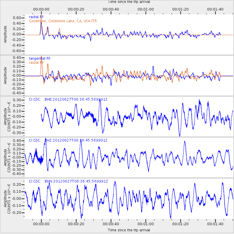
GSC Goldstone, Goldstone Lake, CA, USA - Earthquake Result Viewer
*The percent match for this event was below the threshold and hence no stack was calculated.
| Earthquake location: |
El Salvador |
| Earthquake latitude/longitude: |
13.8/-90.0 |
| Earthquake time(UTC): |
2012/06/27 (179) 06:30:59 GMT |
| Earthquake Depth: |
133 km |
| Earthquake Magnitude: |
5.7 MW, 5.4 MB, 5.7 MW |
| Earthquake Catalog/Contributor: |
WHDF/NEIC |
|
| Network: |
CI Caltech Regional Seismic Network |
| Station: |
GSC Goldstone, Goldstone Lake, CA, USA |
| Lat/Lon: |
35.30 N/116.81 W |
| Elevation: |
1000 m |
|
| Distance: |
32.3 deg |
| Az: |
316.224 deg |
| Baz: |
124.754 deg |
| Ray Param: |
$rayparam |
*The percent match for this event was below the threshold and hence was not used in the summary stack. |
|
| Radial Match: |
61.666348 % |
| Radial Bump: |
400 |
| Transverse Match: |
55.737606 % |
| Transverse Bump: |
400 |
| SOD ConfigId: |
463687 |
| Insert Time: |
2013-02-20 16:18:40.437 +0000 |
| GWidth: |
2.5 |
| Max Bumps: |
400 |
| Tol: |
0.001 |
|
Signal To Noise
| Channel | StoN | STA | LTA |
| CI:GSC: :BHZ:20120627T06:36:45.569991Z | 2.432749 | 2.1800496E-7 | 8.961259E-8 |
| CI:GSC: :BHN:20120627T06:36:45.569991Z | 1.6793724 | 1.3756592E-7 | 8.1915076E-8 |
| CI:GSC: :BHE:20120627T06:36:45.569991Z | 1.4627447 | 1.3954724E-7 | 9.540095E-8 |
| Arrivals |
| Ps | |
| PpPs | |
| PsPs/PpSs | |


