You are here: Home > Network List > CI - Caltech Regional Seismic Network Stations List
> Station FUR Furnace Creek, CA, USA > Earthquake Result Viewer
FUR Furnace Creek, CA, USA - Earthquake Result Viewer
*The percent match for this event was below the threshold and hence no stack was calculated.
| Earthquake location: |
El Salvador |
| Earthquake latitude/longitude: |
13.8/-90.0 |
| Earthquake time(UTC): |
2012/06/27 (179) 06:30:59 GMT |
| Earthquake Depth: |
133 km |
| Earthquake Magnitude: |
5.7 MW, 5.4 MB, 5.7 MW |
| Earthquake Catalog/Contributor: |
WHDF/NEIC |
|
| Network: |
CI Caltech Regional Seismic Network |
| Station: |
FUR Furnace Creek, CA, USA |
| Lat/Lon: |
36.47 N/116.86 W |
| Elevation: |
-37.0 m |
|
| Distance: |
33.0 deg |
| Az: |
317.931 deg |
| Baz: |
126.159 deg |
| Ray Param: |
$rayparam |
*The percent match for this event was below the threshold and hence was not used in the summary stack. |
|
| Radial Match: |
59.56554 % |
| Radial Bump: |
389 |
| Transverse Match: |
65.84041 % |
| Transverse Bump: |
400 |
| SOD ConfigId: |
463687 |
| Insert Time: |
2013-02-20 16:19:20.168 +0000 |
| GWidth: |
2.5 |
| Max Bumps: |
400 |
| Tol: |
0.001 |
|
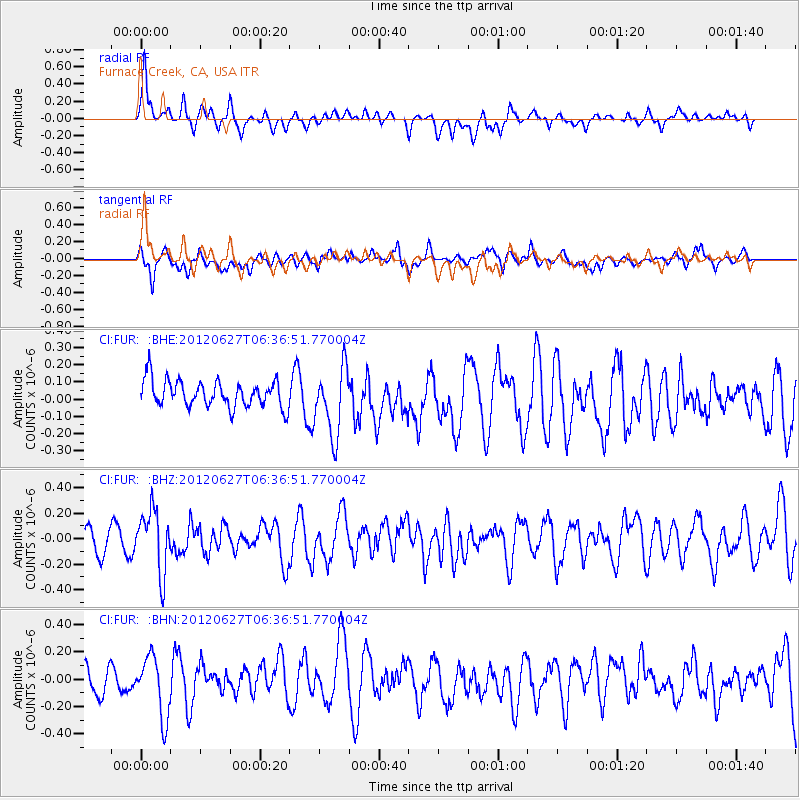
Signal To Noise
| Channel | StoN | STA | LTA |
| CI:FUR: :BHZ:20120627T06:36:51.770004Z | 2.5879326 | 2.4415084E-7 | 9.434204E-8 |
| CI:FUR: :BHN:20120627T06:36:51.770004Z | 1.9988334 | 2.2014503E-7 | 1.1013675E-7 |
| CI:FUR: :BHE:20120627T06:36:51.770004Z | 2.568242 | 1.9721757E-7 | 7.679088E-8 |
| Arrivals |
| Ps | |
| PpPs | |
| PsPs/PpSs | |


