You are here: Home > Network List > CI - Caltech Regional Seismic Network Stations List
> Station MPP McPhearson Peak > Earthquake Result Viewer
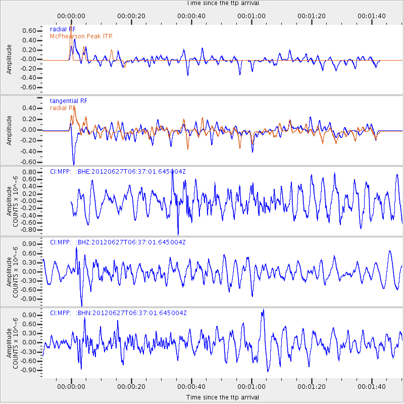
MPP McPhearson Peak - Earthquake Result Viewer
*The percent match for this event was below the threshold and hence no stack was calculated.
| Earthquake location: |
El Salvador |
| Earthquake latitude/longitude: |
13.8/-90.0 |
| Earthquake time(UTC): |
2012/06/27 (179) 06:30:59 GMT |
| Earthquake Depth: |
133 km |
| Earthquake Magnitude: |
5.7 MW, 5.4 MB, 5.7 MW |
| Earthquake Catalog/Contributor: |
WHDF/NEIC |
|
| Network: |
CI Caltech Regional Seismic Network |
| Station: |
MPP McPhearson Peak |
| Lat/Lon: |
34.89 N/119.81 W |
| Elevation: |
1739 m |
|
| Distance: |
34.1 deg |
| Az: |
313.161 deg |
| Baz: |
120.469 deg |
| Ray Param: |
$rayparam |
*The percent match for this event was below the threshold and hence was not used in the summary stack. |
|
| Radial Match: |
57.827526 % |
| Radial Bump: |
400 |
| Transverse Match: |
66.05985 % |
| Transverse Bump: |
400 |
| SOD ConfigId: |
463687 |
| Insert Time: |
2013-02-20 16:20:24.859 +0000 |
| GWidth: |
2.5 |
| Max Bumps: |
400 |
| Tol: |
0.001 |
|
Signal To Noise
| Channel | StoN | STA | LTA |
| CI:MPP: :BHZ:20120627T06:37:01.645004Z | 1.6517092 | 4.3219006E-7 | 2.616623E-7 |
| CI:MPP: :BHN:20120627T06:37:01.645004Z | 1.5615797 | 3.525919E-7 | 2.2579181E-7 |
| CI:MPP: :BHE:20120627T06:37:01.645004Z | 1.106009 | 3.0684512E-7 | 2.7743457E-7 |
| Arrivals |
| Ps | |
| PpPs | |
| PsPs/PpSs | |


