You are here: Home > Network List > TA - USArray Transportable Network (new EarthScope stations) Stations List
> Station MDND Maddock, ND, USA > Earthquake Result Viewer
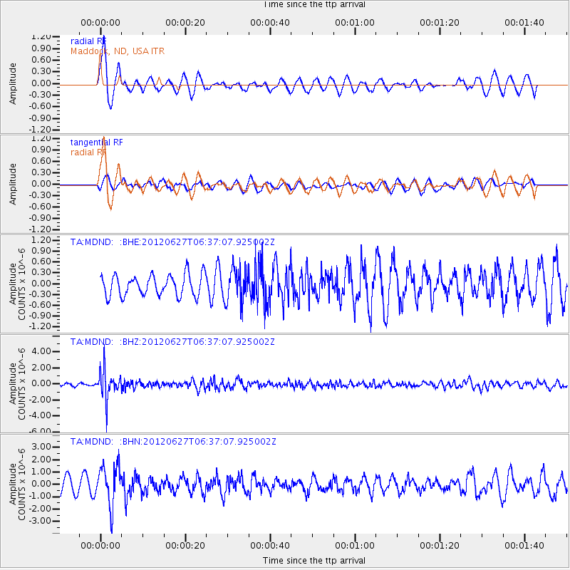
MDND Maddock, ND, USA - Earthquake Result Viewer
*The percent match for this event was below the threshold and hence no stack was calculated.
| Earthquake location: |
El Salvador |
| Earthquake latitude/longitude: |
13.8/-90.0 |
| Earthquake time(UTC): |
2012/06/27 (179) 06:30:59 GMT |
| Earthquake Depth: |
133 km |
| Earthquake Magnitude: |
5.7 MW, 5.4 MB, 5.7 MW |
| Earthquake Catalog/Contributor: |
WHDF/NEIC |
|
| Network: |
TA USArray Transportable Network (new EarthScope stations) |
| Station: |
MDND Maddock, ND, USA |
| Lat/Lon: |
47.85 N/99.60 W |
| Elevation: |
479 m |
|
| Distance: |
34.8 deg |
| Az: |
348.62 deg |
| Baz: |
163.468 deg |
| Ray Param: |
$rayparam |
*The percent match for this event was below the threshold and hence was not used in the summary stack. |
|
| Radial Match: |
65.78506 % |
| Radial Bump: |
353 |
| Transverse Match: |
52.14113 % |
| Transverse Bump: |
400 |
| SOD ConfigId: |
463687 |
| Insert Time: |
2013-02-20 16:25:50.323 +0000 |
| GWidth: |
2.5 |
| Max Bumps: |
400 |
| Tol: |
0.001 |
|
Signal To Noise
| Channel | StoN | STA | LTA |
| TA:MDND: :BHZ:20120627T06:37:07.925002Z | 13.096504 | 1.6931243E-6 | 1.2928064E-7 |
| TA:MDND: :BHN:20120627T06:37:07.925002Z | 2.6890864 | 1.6446066E-6 | 6.115856E-7 |
| TA:MDND: :BHE:20120627T06:37:07.925002Z | 1.5811108 | 4.5759708E-7 | 2.8941494E-7 |
| Arrivals |
| Ps | |
| PpPs | |
| PsPs/PpSs | |


