You are here: Home > Network List > TA - USArray Transportable Network (new EarthScope stations) Stations List
> Station O03D Paynes Creek, CA, USA > Earthquake Result Viewer
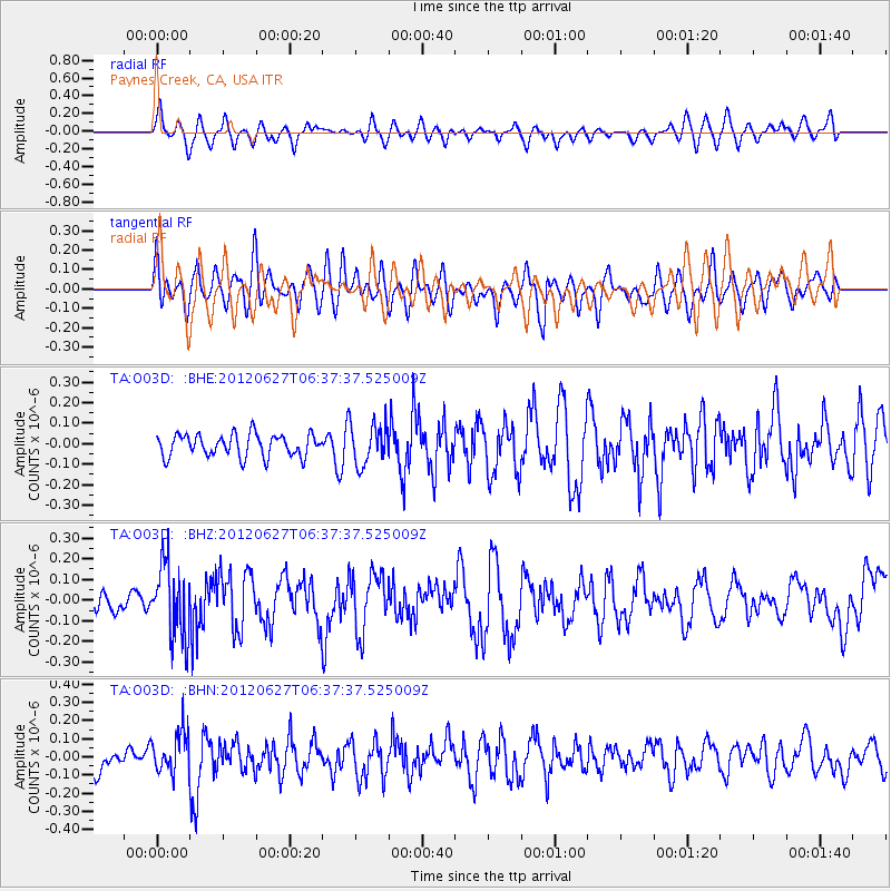
O03D Paynes Creek, CA, USA - Earthquake Result Viewer
*The percent match for this event was below the threshold and hence no stack was calculated.
| Earthquake location: |
El Salvador |
| Earthquake latitude/longitude: |
13.8/-90.0 |
| Earthquake time(UTC): |
2012/06/27 (179) 06:30:59 GMT |
| Earthquake Depth: |
133 km |
| Earthquake Magnitude: |
5.7 MW, 5.4 MB, 5.7 MW |
| Earthquake Catalog/Contributor: |
WHDF/NEIC |
|
| Network: |
TA USArray Transportable Network (new EarthScope stations) |
| Station: |
O03D Paynes Creek, CA, USA |
| Lat/Lon: |
40.29 N/121.80 W |
| Elevation: |
968 m |
|
| Distance: |
38.3 deg |
| Az: |
319.439 deg |
| Baz: |
124.328 deg |
| Ray Param: |
$rayparam |
*The percent match for this event was below the threshold and hence was not used in the summary stack. |
|
| Radial Match: |
55.706974 % |
| Radial Bump: |
400 |
| Transverse Match: |
50.813198 % |
| Transverse Bump: |
400 |
| SOD ConfigId: |
463687 |
| Insert Time: |
2013-02-20 16:26:46.426 +0000 |
| GWidth: |
2.5 |
| Max Bumps: |
400 |
| Tol: |
0.001 |
|
Signal To Noise
| Channel | StoN | STA | LTA |
| TA:O03D: :BHZ:20120627T06:37:37.525009Z | 2.399797 | 1.7545197E-7 | 7.3111174E-8 |
| TA:O03D: :BHN:20120627T06:37:37.525009Z | 1.4145254 | 1.13126056E-7 | 7.997457E-8 |
| TA:O03D: :BHE:20120627T06:37:37.525009Z | 1.8073591 | 9.8474544E-8 | 5.4485323E-8 |
| Arrivals |
| Ps | |
| PpPs | |
| PsPs/PpSs | |


