You are here: Home > Network List > TA - USArray Transportable Network (new EarthScope stations) Stations List
> Station F37A Hinrichs Farm, Grantsburg, WI, USA > Earthquake Result Viewer
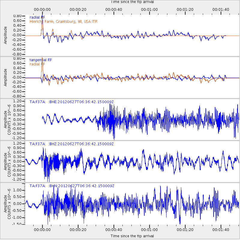
F37A Hinrichs Farm, Grantsburg, WI, USA - Earthquake Result Viewer
*The percent match for this event was below the threshold and hence no stack was calculated.
| Earthquake location: |
El Salvador |
| Earthquake latitude/longitude: |
13.8/-90.0 |
| Earthquake time(UTC): |
2012/06/27 (179) 06:30:59 GMT |
| Earthquake Depth: |
133 km |
| Earthquake Magnitude: |
5.7 MW, 5.4 MB, 5.7 MW |
| Earthquake Catalog/Contributor: |
WHDF/NEIC |
|
| Network: |
TA USArray Transportable Network (new EarthScope stations) |
| Station: |
F37A Hinrichs Farm, Grantsburg, WI, USA |
| Lat/Lon: |
45.72 N/92.63 W |
| Elevation: |
296 m |
|
| Distance: |
31.9 deg |
| Az: |
356.47 deg |
| Baz: |
175.103 deg |
| Ray Param: |
$rayparam |
*The percent match for this event was below the threshold and hence was not used in the summary stack. |
|
| Radial Match: |
66.18072 % |
| Radial Bump: |
400 |
| Transverse Match: |
48.492302 % |
| Transverse Bump: |
400 |
| SOD ConfigId: |
463687 |
| Insert Time: |
2013-02-20 16:31:02.182 +0000 |
| GWidth: |
2.5 |
| Max Bumps: |
400 |
| Tol: |
0.001 |
|
Signal To Noise
| Channel | StoN | STA | LTA |
| TA:F37A: :BHZ:20120627T06:36:42.150009Z | 3.211994 | 5.2608226E-7 | 1.6378682E-7 |
| TA:F37A: :BHN:20120627T06:36:42.150009Z | 2.5480845 | 5.0235946E-7 | 1.9715179E-7 |
| TA:F37A: :BHE:20120627T06:36:42.150009Z | 1.7844968 | 2.6172737E-7 | 1.4666733E-7 |
| Arrivals |
| Ps | |
| PpPs | |
| PsPs/PpSs | |


