You are here: Home > Network List > TA - USArray Transportable Network (new EarthScope stations) Stations List
> Station H42A Shiocton, WI, USA > Earthquake Result Viewer
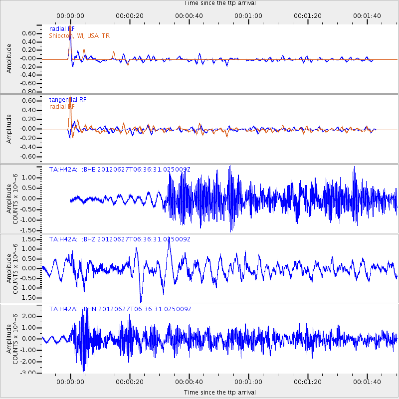
H42A Shiocton, WI, USA - Earthquake Result Viewer
*The percent match for this event was below the threshold and hence no stack was calculated.
| Earthquake location: |
El Salvador |
| Earthquake latitude/longitude: |
13.8/-90.0 |
| Earthquake time(UTC): |
2012/06/27 (179) 06:30:59 GMT |
| Earthquake Depth: |
133 km |
| Earthquake Magnitude: |
5.7 MW, 5.4 MB, 5.7 MW |
| Earthquake Catalog/Contributor: |
WHDF/NEIC |
|
| Network: |
TA USArray Transportable Network (new EarthScope stations) |
| Station: |
H42A Shiocton, WI, USA |
| Lat/Lon: |
44.51 N/88.53 W |
| Elevation: |
244 m |
|
| Distance: |
30.6 deg |
| Az: |
2.019 deg |
| Baz: |
182.741 deg |
| Ray Param: |
$rayparam |
*The percent match for this event was below the threshold and hence was not used in the summary stack. |
|
| Radial Match: |
72.462555 % |
| Radial Bump: |
362 |
| Transverse Match: |
53.197075 % |
| Transverse Bump: |
400 |
| SOD ConfigId: |
463687 |
| Insert Time: |
2013-02-20 16:32:23.556 +0000 |
| GWidth: |
2.5 |
| Max Bumps: |
400 |
| Tol: |
0.001 |
|
Signal To Noise
| Channel | StoN | STA | LTA |
| TA:H42A: :BHZ:20120627T06:36:31.025009Z | 3.4283004 | 5.01644E-7 | 1.463244E-7 |
| TA:H42A: :BHN:20120627T06:36:31.025009Z | 7.305474 | 1.1294977E-6 | 1.5460978E-7 |
| TA:H42A: :BHE:20120627T06:36:31.025009Z | 4.141067 | 4.4575108E-7 | 1.07641604E-7 |
| Arrivals |
| Ps | |
| PpPs | |
| PsPs/PpSs | |


