You are here: Home > Network List > TA - USArray Transportable Network (new EarthScope stations) Stations List
> Station G42A Mountain, WI, USA > Earthquake Result Viewer
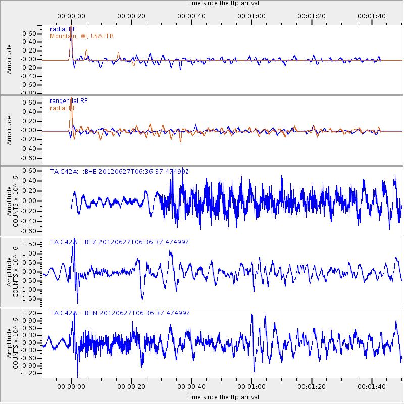
G42A Mountain, WI, USA - Earthquake Result Viewer
*The percent match for this event was below the threshold and hence no stack was calculated.
| Earthquake location: |
El Salvador |
| Earthquake latitude/longitude: |
13.8/-90.0 |
| Earthquake time(UTC): |
2012/06/27 (179) 06:30:59 GMT |
| Earthquake Depth: |
133 km |
| Earthquake Magnitude: |
5.7 MW, 5.4 MB, 5.7 MW |
| Earthquake Catalog/Contributor: |
WHDF/NEIC |
|
| Network: |
TA USArray Transportable Network (new EarthScope stations) |
| Station: |
G42A Mountain, WI, USA |
| Lat/Lon: |
45.24 N/88.43 W |
| Elevation: |
315 m |
|
| Distance: |
31.3 deg |
| Az: |
2.092 deg |
| Baz: |
182.876 deg |
| Ray Param: |
$rayparam |
*The percent match for this event was below the threshold and hence was not used in the summary stack. |
|
| Radial Match: |
70.25386 % |
| Radial Bump: |
338 |
| Transverse Match: |
63.24179 % |
| Transverse Bump: |
400 |
| SOD ConfigId: |
463687 |
| Insert Time: |
2013-02-20 16:32:27.609 +0000 |
| GWidth: |
2.5 |
| Max Bumps: |
400 |
| Tol: |
0.001 |
|
Signal To Noise
| Channel | StoN | STA | LTA |
| TA:G42A: :BHZ:20120627T06:36:37.47499Z | 6.1899304 | 6.670301E-7 | 1.0776053E-7 |
| TA:G42A: :BHN:20120627T06:36:37.47499Z | 4.4772243 | 4.5168892E-7 | 1.0088593E-7 |
| TA:G42A: :BHE:20120627T06:36:37.47499Z | 2.4181347 | 1.8668526E-7 | 7.720217E-8 |
| Arrivals |
| Ps | |
| PpPs | |
| PsPs/PpSs | |


