You are here: Home > Network List > UW - Pacific Northwest Regional Seismic Network Stations List
> Station UMAT Pilot Rock, OR, USA > Earthquake Result Viewer
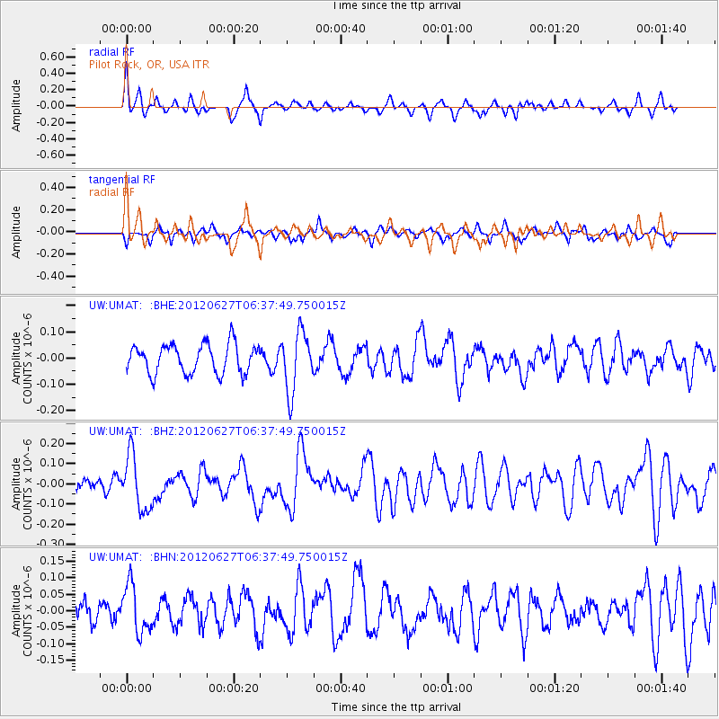
UMAT Pilot Rock, OR, USA - Earthquake Result Viewer
*The percent match for this event was below the threshold and hence no stack was calculated.
| Earthquake location: |
El Salvador |
| Earthquake latitude/longitude: |
13.8/-90.0 |
| Earthquake time(UTC): |
2012/06/27 (179) 06:30:59 GMT |
| Earthquake Depth: |
133 km |
| Earthquake Magnitude: |
5.7 MW, 5.4 MB, 5.7 MW |
| Earthquake Catalog/Contributor: |
WHDF/NEIC |
|
| Network: |
UW Pacific Northwest Regional Seismic Network |
| Station: |
UMAT Pilot Rock, OR, USA |
| Lat/Lon: |
45.29 N/118.96 W |
| Elevation: |
1318 m |
|
| Distance: |
39.8 deg |
| Az: |
327.705 deg |
| Baz: |
132.676 deg |
| Ray Param: |
$rayparam |
*The percent match for this event was below the threshold and hence was not used in the summary stack. |
|
| Radial Match: |
59.47437 % |
| Radial Bump: |
310 |
| Transverse Match: |
61.547115 % |
| Transverse Bump: |
367 |
| SOD ConfigId: |
463687 |
| Insert Time: |
2013-02-20 16:34:04.396 +0000 |
| GWidth: |
2.5 |
| Max Bumps: |
400 |
| Tol: |
0.001 |
|
Signal To Noise
| Channel | StoN | STA | LTA |
| UW:UMAT: :BHZ:20120627T06:37:49.750015Z | 2.8035777 | 1.3700598E-7 | 4.8868266E-8 |
| UW:UMAT: :BHN:20120627T06:37:49.750015Z | 2.9331162 | 7.3711426E-8 | 2.5130754E-8 |
| UW:UMAT: :BHE:20120627T06:37:49.750015Z | 2.083876 | 1.1473646E-7 | 5.505916E-8 |
| Arrivals |
| Ps | |
| PpPs | |
| PsPs/PpSs | |


