You are here: Home > Network List > TA - USArray Transportable Network (new EarthScope stations) Stations List
> Station 556A Lake Butler, FL, USA > Earthquake Result Viewer
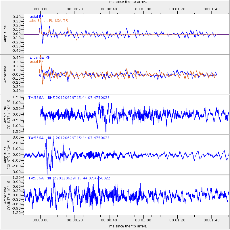
556A Lake Butler, FL, USA - Earthquake Result Viewer
*The percent match for this event was below the threshold and hence no stack was calculated.
| Earthquake location: |
South Atlantic Ocean |
| Earthquake latitude/longitude: |
-24.7/-9.7 |
| Earthquake time(UTC): |
2012/06/29 (181) 15:31:46 GMT |
| Earthquake Depth: |
10 km |
| Earthquake Magnitude: |
6.0 MB, 5.2 MS, 5.8 MW, 5.8 MW |
| Earthquake Catalog/Contributor: |
WHDF/NEIC |
|
| Network: |
TA USArray Transportable Network (new EarthScope stations) |
| Station: |
556A Lake Butler, FL, USA |
| Lat/Lon: |
30.00 N/82.41 W |
| Elevation: |
45 m |
|
| Distance: |
88.5 deg |
| Az: |
304.034 deg |
| Baz: |
119.702 deg |
| Ray Param: |
$rayparam |
*The percent match for this event was below the threshold and hence was not used in the summary stack. |
|
| Radial Match: |
71.416145 % |
| Radial Bump: |
400 |
| Transverse Match: |
49.91836 % |
| Transverse Bump: |
400 |
| SOD ConfigId: |
463687 |
| Insert Time: |
2013-02-20 16:52:47.306 +0000 |
| GWidth: |
2.5 |
| Max Bumps: |
400 |
| Tol: |
0.001 |
|
Signal To Noise
| Channel | StoN | STA | LTA |
| TA:556A: :BHZ:20120629T15:44:07.475002Z | 5.718269 | 1.1388641E-6 | 1.991624E-7 |
| TA:556A: :BHN:20120629T15:44:07.475002Z | 1.1220908 | 2.5526364E-7 | 2.274893E-7 |
| TA:556A: :BHE:20120629T15:44:07.475002Z | 2.3151906 | 5.1830324E-7 | 2.2387066E-7 |
| Arrivals |
| Ps | |
| PpPs | |
| PsPs/PpSs | |


