You are here: Home > Network List > TA - USArray Transportable Network (new EarthScope stations) Stations List
> Station S51A Beattyville, KY, USA > Earthquake Result Viewer
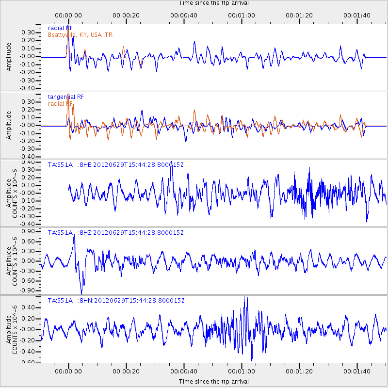
S51A Beattyville, KY, USA - Earthquake Result Viewer
*The percent match for this event was below the threshold and hence no stack was calculated.
| Earthquake location: |
South Atlantic Ocean |
| Earthquake latitude/longitude: |
-24.7/-9.7 |
| Earthquake time(UTC): |
2012/06/29 (181) 15:31:46 GMT |
| Earthquake Depth: |
10 km |
| Earthquake Magnitude: |
6.0 MB, 5.2 MS, 5.8 MW, 5.8 MW |
| Earthquake Catalog/Contributor: |
WHDF/NEIC |
|
| Network: |
TA USArray Transportable Network (new EarthScope stations) |
| Station: |
S51A Beattyville, KY, USA |
| Lat/Lon: |
37.64 N/83.59 W |
| Elevation: |
286 m |
|
| Distance: |
93.1 deg |
| Az: |
310.189 deg |
| Baz: |
118.961 deg |
| Ray Param: |
$rayparam |
*The percent match for this event was below the threshold and hence was not used in the summary stack. |
|
| Radial Match: |
54.607147 % |
| Radial Bump: |
400 |
| Transverse Match: |
57.942585 % |
| Transverse Bump: |
400 |
| SOD ConfigId: |
463687 |
| Insert Time: |
2013-02-20 16:57:32.051 +0000 |
| GWidth: |
2.5 |
| Max Bumps: |
400 |
| Tol: |
0.001 |
|
Signal To Noise
| Channel | StoN | STA | LTA |
| TA:S51A: :BHZ:20120629T15:44:28.800015Z | 3.7779481 | 4.3816482E-7 | 1.15979574E-7 |
| TA:S51A: :BHN:20120629T15:44:28.800015Z | 1.1494917 | 1.0656031E-7 | 9.2702116E-8 |
| TA:S51A: :BHE:20120629T15:44:28.800015Z | 1.4838082 | 1.2427567E-7 | 8.375454E-8 |
| Arrivals |
| Ps | |
| PpPs | |
| PsPs/PpSs | |


