You are here: Home > Network List > TA - USArray Transportable Network (new EarthScope stations) Stations List
> Station P50A Jamestown, OH, USA > Earthquake Result Viewer
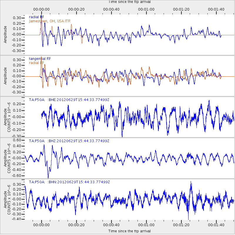
P50A Jamestown, OH, USA - Earthquake Result Viewer
*The percent match for this event was below the threshold and hence no stack was calculated.
| Earthquake location: |
South Atlantic Ocean |
| Earthquake latitude/longitude: |
-24.7/-9.7 |
| Earthquake time(UTC): |
2012/06/29 (181) 15:31:46 GMT |
| Earthquake Depth: |
10 km |
| Earthquake Magnitude: |
6.0 MB, 5.2 MS, 5.8 MW, 5.8 MW |
| Earthquake Catalog/Contributor: |
WHDF/NEIC |
|
| Network: |
TA USArray Transportable Network (new EarthScope stations) |
| Station: |
P50A Jamestown, OH, USA |
| Lat/Lon: |
39.61 N/83.80 W |
| Elevation: |
318 m |
|
| Distance: |
94.1 deg |
| Az: |
311.837 deg |
| Baz: |
118.73 deg |
| Ray Param: |
$rayparam |
*The percent match for this event was below the threshold and hence was not used in the summary stack. |
|
| Radial Match: |
56.54287 % |
| Radial Bump: |
400 |
| Transverse Match: |
54.519295 % |
| Transverse Bump: |
400 |
| SOD ConfigId: |
463687 |
| Insert Time: |
2013-02-20 16:59:04.308 +0000 |
| GWidth: |
2.5 |
| Max Bumps: |
400 |
| Tol: |
0.001 |
|
Signal To Noise
| Channel | StoN | STA | LTA |
| TA:P50A: :BHZ:20120629T15:44:33.77499Z | 3.686872 | 3.0164253E-7 | 8.1815294E-8 |
| TA:P50A: :BHN:20120629T15:44:33.77499Z | 1.5029798 | 1.3708168E-7 | 9.120661E-8 |
| TA:P50A: :BHE:20120629T15:44:33.77499Z | 1.136581 | 9.275185E-8 | 8.1606025E-8 |
| Arrivals |
| Ps | |
| PpPs | |
| PsPs/PpSs | |


