You are here: Home > Network List > GS - US Geological Survey Networks Stations List
> Station KAN13 Rinehart Farm > Earthquake Result Viewer
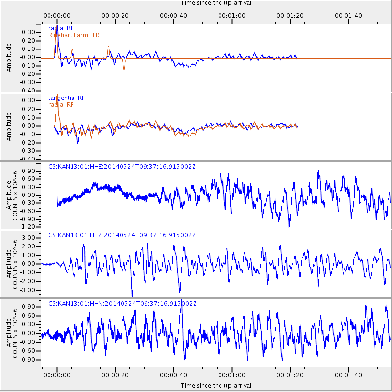
KAN13 Rinehart Farm - Earthquake Result Viewer
*The percent match for this event was below the threshold and hence no stack was calculated.
| Earthquake location: |
Aegean Sea |
| Earthquake latitude/longitude: |
40.3/25.5 |
| Earthquake time(UTC): |
2014/05/24 (144) 09:25:03 GMT |
| Earthquake Depth: |
10 km |
| Earthquake Magnitude: |
6.4 MWP, 6.4 M |
| Earthquake Catalog/Contributor: |
NEIC PDE/NEIC ALERT |
|
| Network: |
GS US Geological Survey Networks |
| Station: |
KAN13 Rinehart Farm |
| Lat/Lon: |
37.01 N/97.48 W |
| Elevation: |
340 m |
|
| Distance: |
86.9 deg |
| Az: |
317.717 deg |
| Baz: |
39.996 deg |
| Ray Param: |
$rayparam |
*The percent match for this event was below the threshold and hence was not used in the summary stack. |
|
| Radial Match: |
54.294224 % |
| Radial Bump: |
400 |
| Transverse Match: |
56.552155 % |
| Transverse Bump: |
400 |
| SOD ConfigId: |
3390531 |
| Insert Time: |
2019-04-12 00:44:03.659 +0000 |
| GWidth: |
2.5 |
| Max Bumps: |
400 |
| Tol: |
0.001 |
|
Signal To Noise
| Channel | StoN | STA | LTA |
| GS:KAN13:01:HHZ:20140524T09:37:16.915002Z | 4.3559566 | 3.8390075E-7 | 8.813237E-8 |
| GS:KAN13:01:HHN:20140524T09:37:16.915002Z | 1.3585738 | 1.466787E-7 | 1.0796521E-7 |
| GS:KAN13:01:HHE:20140524T09:37:16.915002Z | 0.79252005 | 1.675849E-7 | 2.1145826E-7 |
| Arrivals |
| Ps | |
| PpPs | |
| PsPs/PpSs | |


