SSB Saint Sauveur Badole, France - Earthquake Result Viewer
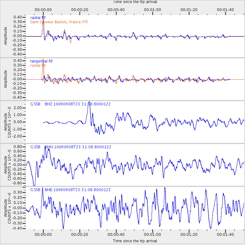
Earthquake location: Andreanof Islands, Aleutian Is.
Earthquake latitude/longitude: 51.5/-178.1
Earthquake time(UTC): 1996/06/08 (160) 23:19:15 GMT
Earthquake Depth: 33 km
Earthquake Magnitude: 5.9 MB, 6.3 MS, 6.5 UNKNOWN, 6.1 MS
Earthquake Catalog/Contributor: WHDF/NEIC
Network: G GEOSCOPE
Station: SSB Saint Sauveur Badole, France
Lat/Lon: 45.28 N/4.54 E
Elevation: 700 m
Distance: 83.6 deg
Az: 358.103 deg
Baz: 1.679 deg
Ray Param: 0.0460412
Estimated Moho Depth: 17.75 km
Estimated Crust Vp/Vs: 1.88
Assumed Crust Vp: 6.1 km/s
Estimated Crust Vs: 3.249 km/s
Estimated Crust Poisson's Ratio: 0.30
Radial Match: 92.36291 %
Radial Bump: 394
Transverse Match: 70.51559 %
Transverse Bump: 400
SOD ConfigId: 6273
Insert Time: 2010-02-27 00:10:12.871 +0000
GWidth: 2.5
Max Bumps: 400
Tol: 0.001

Signal To Noise

ChannelStoNSTALTA
G:SSB: :BHN:19960608T23:31:08.800012Z3.1910975.0742807E-71.5901368E-7
G:SSB: :BHE:19960608T23:31:08.800012Z1.76368331.6882436E-79.57226E-8
G:SSB: :BHZ:19960608T23:31:08.800012Z2.91477731.1761333E-64.035071E-7
Arrivals
Ps2.6 SECOND
PpPs8.2 SECOND
PsPs/PpSs11 SECOND