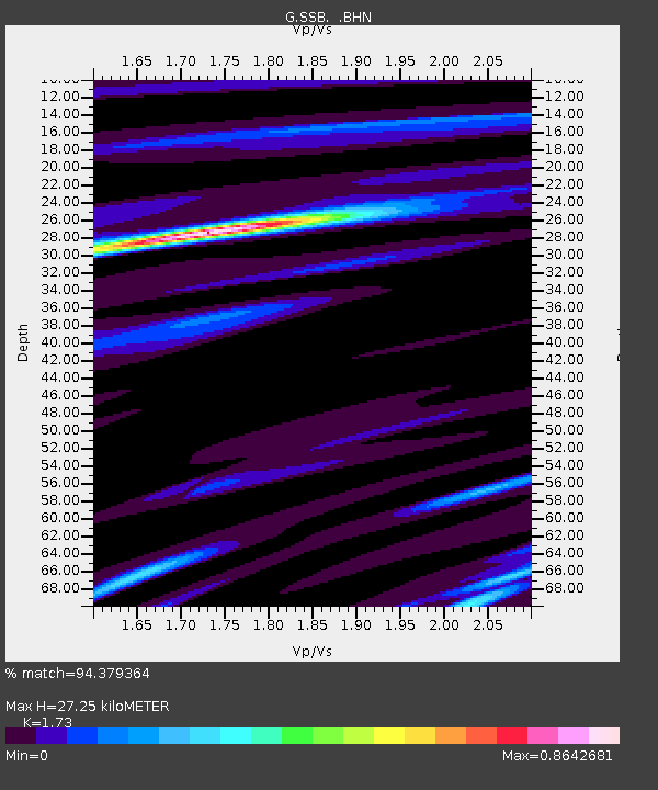
SSB Saint Sauveur Badole, France - Earthquake Result Viewer
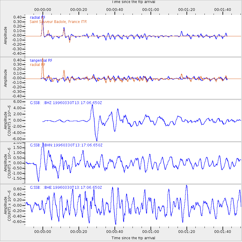
Earthquake location: Fox Islands, Aleutian Islands
Earthquake latitude/longitude: 52.2/-168.7
Earthquake time(UTC): 1996/03/30 (090) 13:05:17 GMT
Earthquake Depth: 33 km
Earthquake Magnitude: 5.9 MB, 6.2 MS, 6.3 UNKNOWN, 6.1 ML
Earthquake Catalog/Contributor: WHDF/NEIC
Network: G GEOSCOPE
Station: SSB Saint Sauveur Badole, France
Lat/Lon: 45.28 N/4.54 E
Elevation: 700 m
Distance: 82.7 deg
Az: 4.781 deg
Baz: 355.835 deg
Ray Param: 0.046652287
Estimated Moho Depth: 27.25 km
Estimated Crust Vp/Vs: 1.73
Assumed Crust Vp: 6.1 km/s
Estimated Crust Vs: 3.526 km/s
Estimated Crust Poisson's Ratio: 0.25
Radial Match: 94.379364 %
Radial Bump: 400
Transverse Match: 79.27421 %
Transverse Bump: 400
SOD ConfigId: 6273
Insert Time: 2010-02-27 00:10:16.288 +0000
GWidth: 2.5
Max Bumps: 400
Tol: 0.001

Signal To Noise

ChannelStoNSTALTA
G:SSB: :BHN:19960330T13:17:06.650Z12.3979381.0227085E-68.249021E-8
G:SSB: :BHE:19960330T13:17:06.650Z1.9814612.2053568E-71.1129953E-7
G:SSB: :BHZ:19960330T13:17:06.650Z18.4506653.005448E-61.6289104E-7
Arrivals
Ps3.3 SECOND
PpPs12 SECOND
PsPs/PpSs15 SECOND