You are here: Home > Network List > TA - USArray Transportable Network (new EarthScope stations) Stations List
> Station O48A Farmland, IN, USA > Earthquake Result Viewer
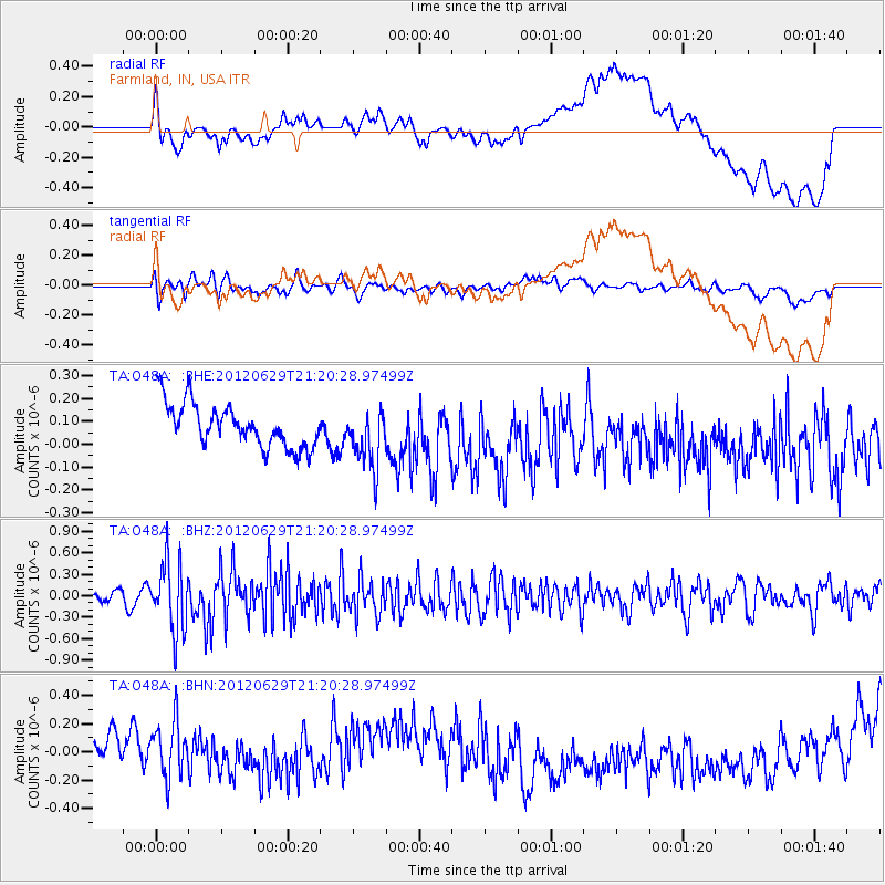
O48A Farmland, IN, USA - Earthquake Result Viewer
*The percent match for this event was below the threshold and hence no stack was calculated.
| Earthquake location: |
Northern Xinjiang, China |
| Earthquake latitude/longitude: |
43.4/84.7 |
| Earthquake time(UTC): |
2012/06/29 (181) 21:07:33 GMT |
| Earthquake Depth: |
18 km |
| Earthquake Magnitude: |
6.2 MB, 6.4 MS, 6.3 MW, 6.3 MW |
| Earthquake Catalog/Contributor: |
WHDF/NEIC |
|
| Network: |
TA USArray Transportable Network (new EarthScope stations) |
| Station: |
O48A Farmland, IN, USA |
| Lat/Lon: |
40.26 N/85.16 W |
| Elevation: |
300 m |
|
| Distance: |
96.2 deg |
| Az: |
352.208 deg |
| Baz: |
7.415 deg |
| Ray Param: |
$rayparam |
*The percent match for this event was below the threshold and hence was not used in the summary stack. |
|
| Radial Match: |
34.792496 % |
| Radial Bump: |
400 |
| Transverse Match: |
39.853333 % |
| Transverse Bump: |
400 |
| SOD ConfigId: |
463687 |
| Insert Time: |
2013-02-20 17:29:34.776 +0000 |
| GWidth: |
2.5 |
| Max Bumps: |
400 |
| Tol: |
0.001 |
|
Signal To Noise
| Channel | StoN | STA | LTA |
| TA:O48A: :BHZ:20120629T21:20:28.97499Z | 7.4547505 | 4.856848E-7 | 6.515104E-8 |
| TA:O48A: :BHN:20120629T21:20:28.97499Z | 1.3815587 | 1.912948E-7 | 1.3846304E-7 |
| TA:O48A: :BHE:20120629T21:20:28.97499Z | 1.3697132 | 1.3008291E-7 | 9.497092E-8 |
| Arrivals |
| Ps | |
| PpPs | |
| PsPs/PpSs | |


