You are here: Home > Network List > UW - Pacific Northwest Regional Seismic Network Stations List
> Station MRBL Marblemount, WA, USA > Earthquake Result Viewer
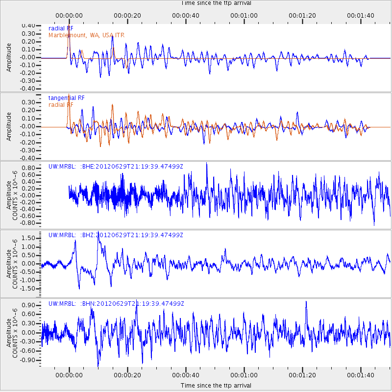
MRBL Marblemount, WA, USA - Earthquake Result Viewer
*The percent match for this event was below the threshold and hence no stack was calculated.
| Earthquake location: |
Northern Xinjiang, China |
| Earthquake latitude/longitude: |
43.4/84.7 |
| Earthquake time(UTC): |
2012/06/29 (181) 21:07:33 GMT |
| Earthquake Depth: |
18 km |
| Earthquake Magnitude: |
6.2 MB, 6.4 MS, 6.3 MW, 6.3 MW |
| Earthquake Catalog/Contributor: |
WHDF/NEIC |
|
| Network: |
UW Pacific Northwest Regional Seismic Network |
| Station: |
MRBL Marblemount, WA, USA |
| Lat/Lon: |
48.52 N/121.48 W |
| Elevation: |
75 m |
|
| Distance: |
85.6 deg |
| Az: |
17.113 deg |
| Baz: |
341.191 deg |
| Ray Param: |
$rayparam |
*The percent match for this event was below the threshold and hence was not used in the summary stack. |
|
| Radial Match: |
68.54302 % |
| Radial Bump: |
400 |
| Transverse Match: |
72.77415 % |
| Transverse Bump: |
400 |
| SOD ConfigId: |
463687 |
| Insert Time: |
2013-02-20 17:32:00.547 +0000 |
| GWidth: |
2.5 |
| Max Bumps: |
400 |
| Tol: |
0.001 |
|
Signal To Noise
| Channel | StoN | STA | LTA |
| UW:MRBL: :BHZ:20120629T21:19:39.47499Z | 7.7435126 | 6.3813053E-7 | 8.2408405E-8 |
| UW:MRBL: :BHN:20120629T21:19:39.47499Z | 1.4945256 | 2.7046315E-7 | 1.8096924E-7 |
| UW:MRBL: :BHE:20120629T21:19:39.47499Z | 0.8966392 | 1.8290673E-7 | 2.0399143E-7 |
| Arrivals |
| Ps | |
| PpPs | |
| PsPs/PpSs | |


