You are here: Home > Network List > AZ - ANZA Regional Network Stations List
> Station LVA2 AZ.LVA2 > Earthquake Result Viewer
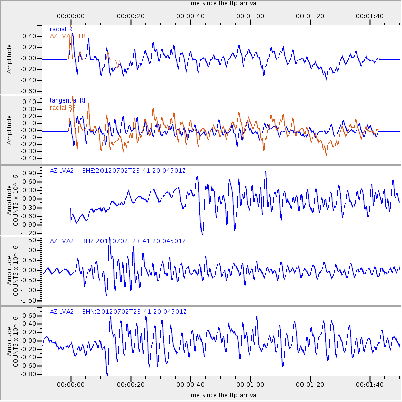
LVA2 AZ.LVA2 - Earthquake Result Viewer
*The percent match for this event was below the threshold and hence no stack was calculated.
| Earthquake location: |
Near Coast Of Peru |
| Earthquake latitude/longitude: |
-14.4/-75.6 |
| Earthquake time(UTC): |
2012/07/02 (184) 23:31:37 GMT |
| Earthquake Depth: |
40 km |
| Earthquake Magnitude: |
6.0 MB, 5.2 MS, 5.7 MW, 5.6 MW |
| Earthquake Catalog/Contributor: |
WHDF/NEIC |
|
| Network: |
AZ ANZA Regional Network |
| Station: |
LVA2 AZ.LVA2 |
| Lat/Lon: |
33.35 N/116.56 W |
| Elevation: |
1435 m |
|
| Distance: |
61.5 deg |
| Az: |
321.369 deg |
| Baz: |
133.725 deg |
| Ray Param: |
$rayparam |
*The percent match for this event was below the threshold and hence was not used in the summary stack. |
|
| Radial Match: |
41.76014 % |
| Radial Bump: |
400 |
| Transverse Match: |
73.226326 % |
| Transverse Bump: |
400 |
| SOD ConfigId: |
463687 |
| Insert Time: |
2013-02-20 17:45:57.291 +0000 |
| GWidth: |
2.5 |
| Max Bumps: |
400 |
| Tol: |
0.001 |
|
Signal To Noise
| Channel | StoN | STA | LTA |
| AZ:LVA2: :BHZ:20120702T23:41:20.04501Z | 2.851703 | 2.8509834E-7 | 9.997477E-8 |
| AZ:LVA2: :BHN:20120702T23:41:20.04501Z | 1.6799062 | 4.267745E-7 | 2.5404663E-7 |
| AZ:LVA2: :BHE:20120702T23:41:20.04501Z | 1.5187575 | 4.1306387E-7 | 2.719749E-7 |
| Arrivals |
| Ps | |
| PpPs | |
| PsPs/PpSs | |


