SSB Saint Sauveur Badole, France - Earthquake Result Viewer
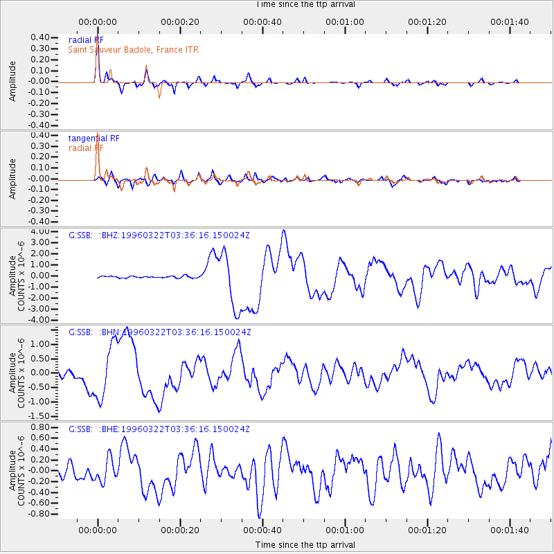
Earthquake location: Rat Islands, Aleutian Islands
Earthquake latitude/longitude: 51.2/178.7
Earthquake time(UTC): 1996/03/22 (082) 03:24:20 GMT
Earthquake Depth: 20 km
Earthquake Magnitude: 5.7 MB, 6.6 MS, 6.8 UNKNOWN, 6.6 ML
Earthquake Catalog/Contributor: WHDF/NEIC
Network: G GEOSCOPE
Station: SSB Saint Sauveur Badole, France
Lat/Lon: 45.28 N/4.54 E
Elevation: 700 m
Distance: 83.7 deg
Az: 355.851 deg
Baz: 3.695 deg
Ray Param: 0.045950055
Estimated Moho Depth: 28.25 km
Estimated Crust Vp/Vs: 1.65
Assumed Crust Vp: 6.1 km/s
Estimated Crust Vs: 3.691 km/s
Estimated Crust Poisson's Ratio: 0.21
Radial Match: 96.431786 %
Radial Bump: 230
Transverse Match: 85.019585 %
Transverse Bump: 400
SOD ConfigId: 6273
Insert Time: 2010-02-27 00:10:37.074 +0000
GWidth: 2.5
Max Bumps: 400
Tol: 0.001

Signal To Noise

ChannelStoNSTALTA
G:SSB: :BHN:19960322T03:36:16.150024Z12.6318219.5134243E-77.531316E-8
G:SSB: :BHE:19960322T03:36:16.150024Z2.09646562.1353785E-71.01856116E-7
G:SSB: :BHZ:19960322T03:36:16.150024Z32.2936172.5251156E-67.81924E-8
Arrivals
Ps3.1 SECOND
PpPs12 SECOND
PsPs/PpSs15 SECOND