You are here: Home > Network List > CI - Caltech Regional Seismic Network Stations List
> Station SWS Sam W. Stewart, Westmorland, CA, USA > Earthquake Result Viewer
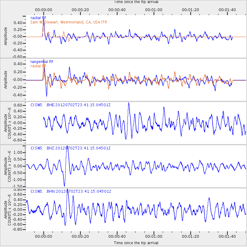
SWS Sam W. Stewart, Westmorland, CA, USA - Earthquake Result Viewer
*The percent match for this event was below the threshold and hence no stack was calculated.
| Earthquake location: |
Near Coast Of Peru |
| Earthquake latitude/longitude: |
-14.4/-75.6 |
| Earthquake time(UTC): |
2012/07/02 (184) 23:31:37 GMT |
| Earthquake Depth: |
40 km |
| Earthquake Magnitude: |
6.0 MB, 5.2 MS, 5.7 MW, 5.6 MW |
| Earthquake Catalog/Contributor: |
WHDF/NEIC |
|
| Network: |
CI Caltech Regional Seismic Network |
| Station: |
SWS Sam W. Stewart, Westmorland, CA, USA |
| Lat/Lon: |
32.94 N/115.80 W |
| Elevation: |
140 m |
|
| Distance: |
60.8 deg |
| Az: |
321.542 deg |
| Baz: |
134.225 deg |
| Ray Param: |
$rayparam |
*The percent match for this event was below the threshold and hence was not used in the summary stack. |
|
| Radial Match: |
76.84414 % |
| Radial Bump: |
400 |
| Transverse Match: |
64.27825 % |
| Transverse Bump: |
353 |
| SOD ConfigId: |
463687 |
| Insert Time: |
2013-02-20 17:48:41.260 +0000 |
| GWidth: |
2.5 |
| Max Bumps: |
400 |
| Tol: |
0.001 |
|
Signal To Noise
| Channel | StoN | STA | LTA |
| CI:SWS: :BHZ:20120702T23:41:15.04501Z | 3.0402405 | 3.2823934E-7 | 1.0796493E-7 |
| CI:SWS: :BHN:20120702T23:41:15.04501Z | 0.97092265 | 2.064044E-7 | 2.1258583E-7 |
| CI:SWS: :BHE:20120702T23:41:15.04501Z | 0.8393374 | 1.2210263E-7 | 1.4547501E-7 |
| Arrivals |
| Ps | |
| PpPs | |
| PsPs/PpSs | |


