You are here: Home > Network List > CI - Caltech Regional Seismic Network Stations List
> Station SMM Simmler, CA, USA > Earthquake Result Viewer
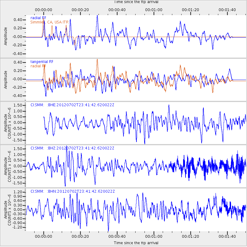
SMM Simmler, CA, USA - Earthquake Result Viewer
*The percent match for this event was below the threshold and hence no stack was calculated.
| Earthquake location: |
Near Coast Of Peru |
| Earthquake latitude/longitude: |
-14.4/-75.6 |
| Earthquake time(UTC): |
2012/07/02 (184) 23:31:37 GMT |
| Earthquake Depth: |
40 km |
| Earthquake Magnitude: |
6.0 MB, 5.2 MS, 5.7 MW, 5.6 MW |
| Earthquake Catalog/Contributor: |
WHDF/NEIC |
|
| Network: |
CI Caltech Regional Seismic Network |
| Station: |
SMM Simmler, CA, USA |
| Lat/Lon: |
35.31 N/120.00 W |
| Elevation: |
599 m |
|
| Distance: |
64.9 deg |
| Az: |
320.826 deg |
| Baz: |
131.551 deg |
| Ray Param: |
$rayparam |
*The percent match for this event was below the threshold and hence was not used in the summary stack. |
|
| Radial Match: |
52.695484 % |
| Radial Bump: |
400 |
| Transverse Match: |
51.048405 % |
| Transverse Bump: |
400 |
| SOD ConfigId: |
463687 |
| Insert Time: |
2013-02-20 17:49:26.153 +0000 |
| GWidth: |
2.5 |
| Max Bumps: |
400 |
| Tol: |
0.001 |
|
Signal To Noise
| Channel | StoN | STA | LTA |
| CI:SMM: :BHZ:20120702T23:41:42.620022Z | 2.5575635 | 4.4906548E-7 | 1.7558332E-7 |
| CI:SMM: :BHN:20120702T23:41:42.620022Z | 1.6100795 | 4.2792792E-7 | 2.657806E-7 |
| CI:SMM: :BHE:20120702T23:41:42.620022Z | 0.912939 | 3.82017E-7 | 4.1844743E-7 |
| Arrivals |
| Ps | |
| PpPs | |
| PsPs/PpSs | |


