You are here: Home > Network List > CI - Caltech Regional Seismic Network Stations List
> Station MPP McPhearson Peak > Earthquake Result Viewer
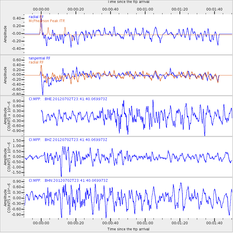
MPP McPhearson Peak - Earthquake Result Viewer
*The percent match for this event was below the threshold and hence no stack was calculated.
| Earthquake location: |
Near Coast Of Peru |
| Earthquake latitude/longitude: |
-14.4/-75.6 |
| Earthquake time(UTC): |
2012/07/02 (184) 23:31:37 GMT |
| Earthquake Depth: |
40 km |
| Earthquake Magnitude: |
6.0 MB, 5.2 MS, 5.7 MW, 5.6 MW |
| Earthquake Catalog/Contributor: |
WHDF/NEIC |
|
| Network: |
CI Caltech Regional Seismic Network |
| Station: |
MPP McPhearson Peak |
| Lat/Lon: |
34.89 N/119.81 W |
| Elevation: |
1739 m |
|
| Distance: |
64.5 deg |
| Az: |
320.584 deg |
| Baz: |
131.552 deg |
| Ray Param: |
$rayparam |
*The percent match for this event was below the threshold and hence was not used in the summary stack. |
|
| Radial Match: |
66.400314 % |
| Radial Bump: |
400 |
| Transverse Match: |
59.27455 % |
| Transverse Bump: |
400 |
| SOD ConfigId: |
463687 |
| Insert Time: |
2013-02-20 17:49:44.809 +0000 |
| GWidth: |
2.5 |
| Max Bumps: |
400 |
| Tol: |
0.001 |
|
Signal To Noise
| Channel | StoN | STA | LTA |
| CI:MPP: :BHZ:20120702T23:41:40.069973Z | 1.2864524 | 2.6768893E-7 | 2.0808304E-7 |
| CI:MPP: :BHN:20120702T23:41:40.069973Z | 1.1036729 | 4.0057697E-7 | 3.62949E-7 |
| CI:MPP: :BHE:20120702T23:41:40.069973Z | 0.858069 | 1.709615E-7 | 1.9923979E-7 |
| Arrivals |
| Ps | |
| PpPs | |
| PsPs/PpSs | |


