SSB Saint Sauveur Badole, France - Earthquake Result Viewer
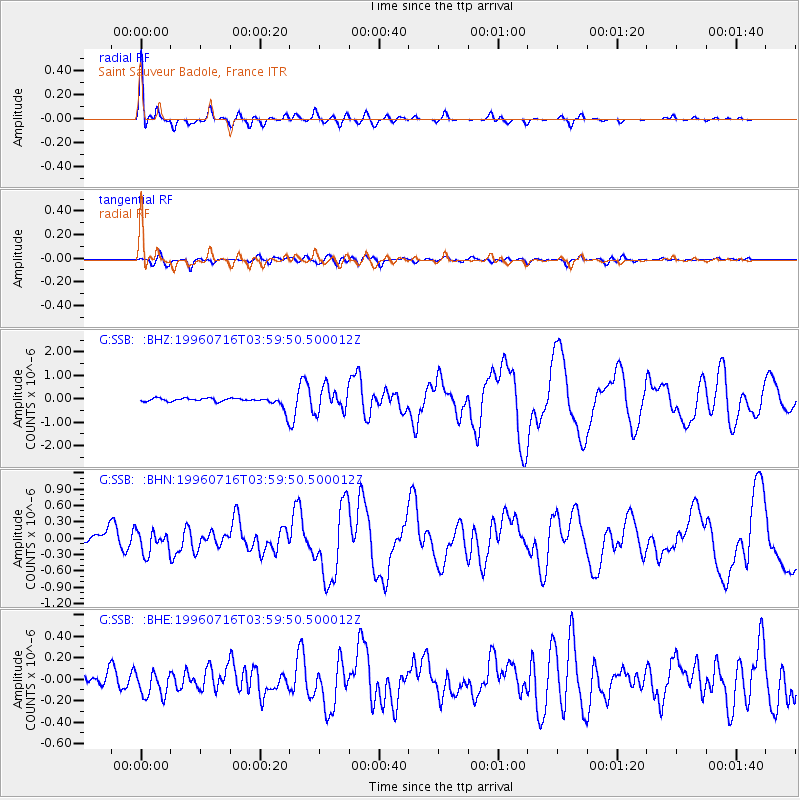
Earthquake location: Komandorskiye Ostrova Region
Earthquake latitude/longitude: 56.1/165.0
Earthquake time(UTC): 1996/07/16 (198) 03:48:28 GMT
Earthquake Depth: 33 km
Earthquake Magnitude: 5.8 MB, 6.4 MS, 6.5 UNKNOWN, 6.3 MW
Earthquake Catalog/Contributor: WHDF/NEIC
Network: G GEOSCOPE
Station: SSB Saint Sauveur Badole, France
Lat/Lon: 45.28 N/4.54 E
Elevation: 700 m
Distance: 77.7 deg
Az: 346.009 deg
Baz: 11.067 deg
Ray Param: 0.05011567
Estimated Moho Depth: 26.25 km
Estimated Crust Vp/Vs: 1.82
Assumed Crust Vp: 6.1 km/s
Estimated Crust Vs: 3.361 km/s
Estimated Crust Poisson's Ratio: 0.28
Radial Match: 95.02677 %
Radial Bump: 348
Transverse Match: 77.558174 %
Transverse Bump: 400
SOD ConfigId: 6273
Insert Time: 2010-02-27 00:10:44.999 +0000
GWidth: 2.5
Max Bumps: 400
Tol: 0.001

Signal To Noise

ChannelStoNSTALTA
G:SSB: :BHN:19960716T03:59:50.500012Z3.29671812.0531449E-76.227845E-8
G:SSB: :BHE:19960716T03:59:50.500012Z2.42337471.1860836E-74.894347E-8
G:SSB: :BHZ:19960716T03:59:50.500012Z3.03519635.1008396E-71.6805635E-7
Arrivals
Ps3.6 SECOND
PpPs12 SECOND
PsPs/PpSs15 SECOND