You are here: Home > Network List > LD - Lamont-Doherty Cooperative Seismographic Network Stations List
> Station BRNJ Basking Ridge, New Jersey > Earthquake Result Viewer
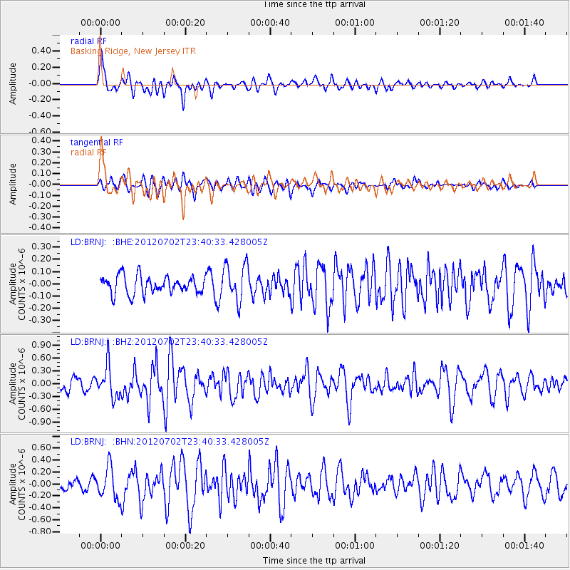
BRNJ Basking Ridge, New Jersey - Earthquake Result Viewer
*The percent match for this event was below the threshold and hence no stack was calculated.
| Earthquake location: |
Near Coast Of Peru |
| Earthquake latitude/longitude: |
-14.4/-75.6 |
| Earthquake time(UTC): |
2012/07/02 (184) 23:31:37 GMT |
| Earthquake Depth: |
40 km |
| Earthquake Magnitude: |
6.0 MB, 5.2 MS, 5.7 MW, 5.6 MW |
| Earthquake Catalog/Contributor: |
WHDF/NEIC |
|
| Network: |
LD Lamont-Doherty Cooperative Seismographic Network |
| Station: |
BRNJ Basking Ridge, New Jersey |
| Lat/Lon: |
40.68 N/74.57 W |
| Elevation: |
50 m |
|
| Distance: |
54.8 deg |
| Az: |
0.96 deg |
| Baz: |
181.223 deg |
| Ray Param: |
$rayparam |
*The percent match for this event was below the threshold and hence was not used in the summary stack. |
|
| Radial Match: |
78.12652 % |
| Radial Bump: |
400 |
| Transverse Match: |
52.40401 % |
| Transverse Bump: |
400 |
| SOD ConfigId: |
463687 |
| Insert Time: |
2013-02-20 17:55:26.768 +0000 |
| GWidth: |
2.5 |
| Max Bumps: |
400 |
| Tol: |
0.001 |
|
Signal To Noise
| Channel | StoN | STA | LTA |
| LD:BRNJ: :BHZ:20120702T23:40:33.428005Z | 2.6742258 | 3.8771873E-7 | 1.4498355E-7 |
| LD:BRNJ: :BHN:20120702T23:40:33.428005Z | 3.848121 | 2.7254774E-7 | 7.082619E-8 |
| LD:BRNJ: :BHE:20120702T23:40:33.428005Z | 2.1693778 | 1.5614815E-7 | 7.1978306E-8 |
| Arrivals |
| Ps | |
| PpPs | |
| PsPs/PpSs | |


