You are here: Home > Network List > TA - USArray Transportable Network (new EarthScope stations) Stations List
> Station Y12C Blythe, CA, USA > Earthquake Result Viewer
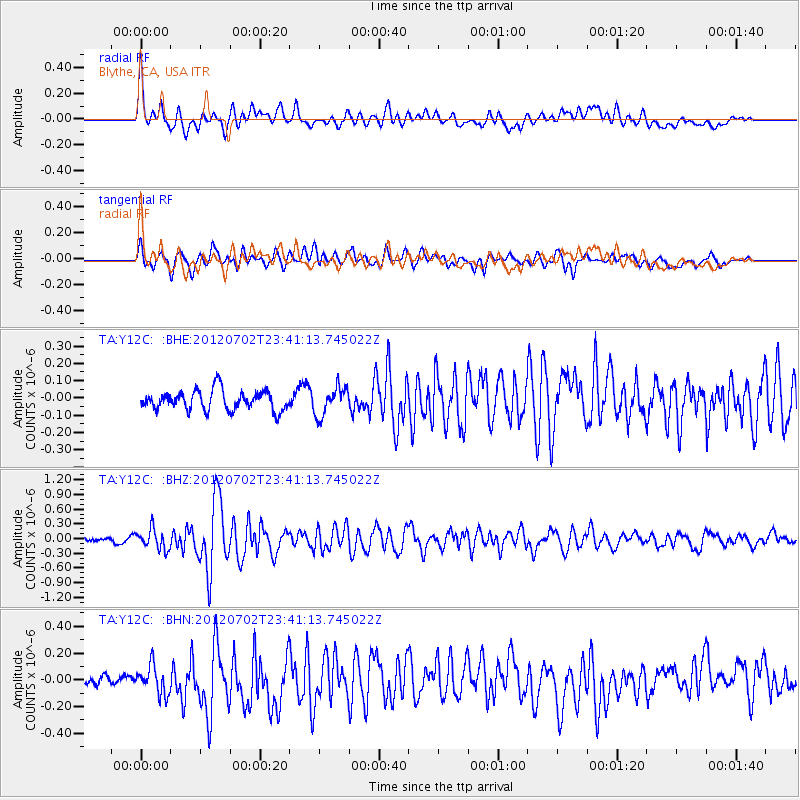
Y12C Blythe, CA, USA - Earthquake Result Viewer
*The percent match for this event was below the threshold and hence no stack was calculated.
| Earthquake location: |
Near Coast Of Peru |
| Earthquake latitude/longitude: |
-14.4/-75.6 |
| Earthquake time(UTC): |
2012/07/02 (184) 23:31:37 GMT |
| Earthquake Depth: |
40 km |
| Earthquake Magnitude: |
6.0 MB, 5.2 MS, 5.7 MW, 5.6 MW |
| Earthquake Catalog/Contributor: |
WHDF/NEIC |
|
| Network: |
TA USArray Transportable Network (new EarthScope stations) |
| Station: |
Y12C Blythe, CA, USA |
| Lat/Lon: |
33.75 N/114.52 W |
| Elevation: |
196 m |
|
| Distance: |
60.6 deg |
| Az: |
323.06 deg |
| Baz: |
135.664 deg |
| Ray Param: |
$rayparam |
*The percent match for this event was below the threshold and hence was not used in the summary stack. |
|
| Radial Match: |
73.631676 % |
| Radial Bump: |
400 |
| Transverse Match: |
77.239 % |
| Transverse Bump: |
400 |
| SOD ConfigId: |
463687 |
| Insert Time: |
2013-02-20 18:00:25.822 +0000 |
| GWidth: |
2.5 |
| Max Bumps: |
400 |
| Tol: |
0.001 |
|
Signal To Noise
| Channel | StoN | STA | LTA |
| TA:Y12C: :BHZ:20120702T23:41:13.745022Z | 3.3315365 | 2.0422723E-7 | 6.1301215E-8 |
| TA:Y12C: :BHN:20120702T23:41:13.745022Z | 1.599098 | 1.07364336E-7 | 6.714056E-8 |
| TA:Y12C: :BHE:20120702T23:41:13.745022Z | 1.4567324 | 8.193581E-8 | 5.6246304E-8 |
| Arrivals |
| Ps | |
| PpPs | |
| PsPs/PpSs | |


