
SSB Saint Sauveur Badole, France - Earthquake Result Viewer
| ||||||||||||||||||
| ||||||||||||||||||
| ||||||||||||||||||
|
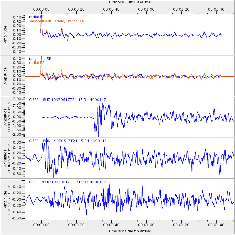
Signal To Noise
| Channel | StoN | STA | LTA |
| G:SSB: :BHN:19970617T21:15:34.499011Z | 8.1884365 | 3.786924E-7 | 4.6247216E-8 |
| G:SSB: :BHE:19970617T21:15:34.499011Z | 0.72820467 | 5.3893274E-8 | 7.400842E-8 |
| G:SSB: :BHZ:19970617T21:15:34.499011Z | 15.4219675 | 1.0675569E-6 | 6.9223134E-8 |
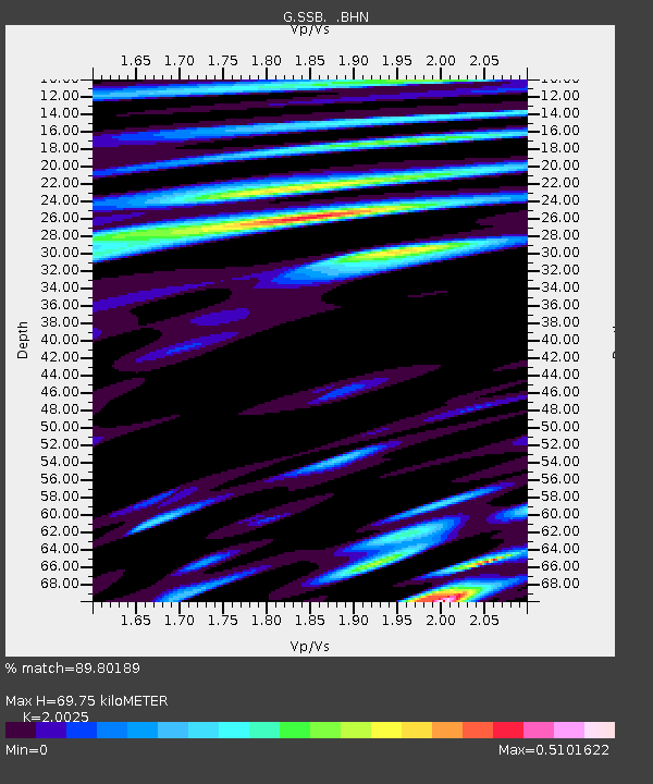
| Arrivals | |
| Ps | 12 SECOND |
| PpPs | 34 SECOND |
| PsPs/PpSs | 45 SECOND |

