
SSB Saint Sauveur Badole, France - Earthquake Result Viewer
| ||||||||||||||||||
| ||||||||||||||||||
| ||||||||||||||||||
|
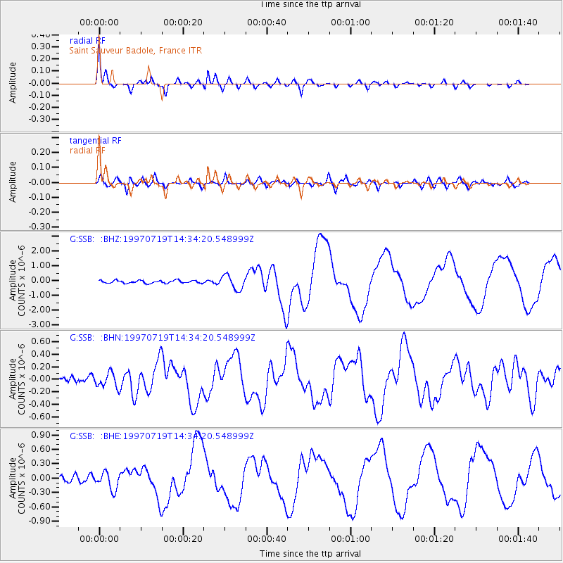
Signal To Noise
| Channel | StoN | STA | LTA |
| G:SSB: :BHN:19970719T14:34:20.548999Z | 2.4425576 | 1.1971933E-7 | 4.9013927E-8 |
| G:SSB: :BHE:19970719T14:34:20.548999Z | 2.8924088 | 1.8926113E-7 | 6.543374E-8 |
| G:SSB: :BHZ:19970719T14:34:20.548999Z | 5.2293577 | 4.842041E-7 | 9.2593424E-8 |
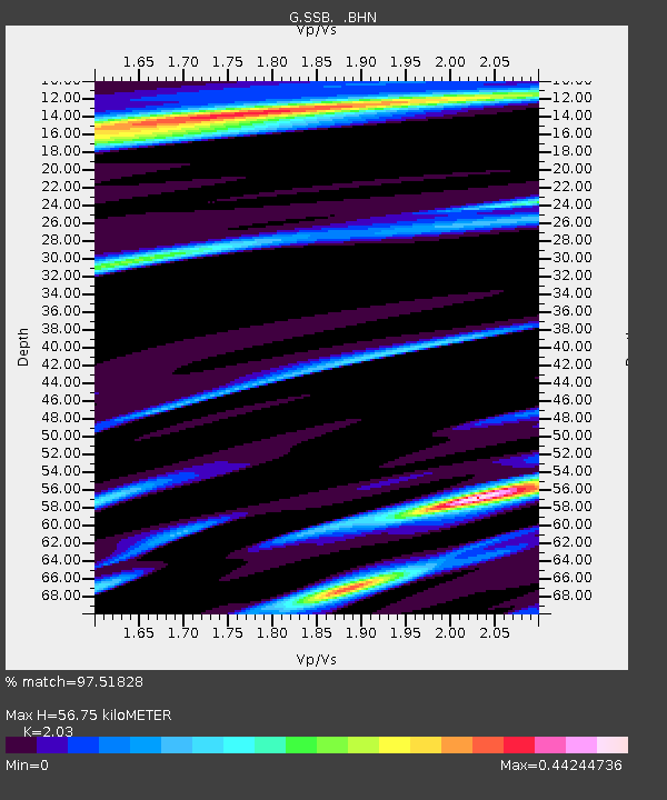
| Arrivals | |
| Ps | 9.8 SECOND |
| PpPs | 28 SECOND |
| PsPs/PpSs | 37 SECOND |

