SSB Saint Sauveur Badole, France - Earthquake Result Viewer
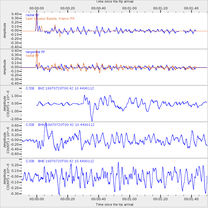
Earthquake location: Fox Islands, Aleutian Islands
Earthquake latitude/longitude: 52.6/-167.5
Earthquake time(UTC): 1997/07/20 (201) 00:30:20 GMT
Earthquake Depth: 14 km
Earthquake Magnitude: 5.6 MB, 5.9 MS, 6.2 UNKNOWN, 6.2 MW
Earthquake Catalog/Contributor: WHDF/NEIC
Network: G GEOSCOPE
Station: SSB Saint Sauveur Badole, France
Lat/Lon: 45.28 N/4.54 E
Elevation: 700 m
Distance: 82.3 deg
Az: 5.672 deg
Baz: 355.098 deg
Ray Param: 0.046978287
Estimated Moho Depth: 64.75 km
Estimated Crust Vp/Vs: 1.94
Assumed Crust Vp: 6.1 km/s
Estimated Crust Vs: 3.14 km/s
Estimated Crust Poisson's Ratio: 0.32
Radial Match: 90.42248 %
Radial Bump: 366
Transverse Match: 66.05199 %
Transverse Bump: 400
SOD ConfigId: 6273
Insert Time: 2010-02-27 00:11:10.521 +0000
GWidth: 2.5
Max Bumps: 400
Tol: 0.001

Signal To Noise

ChannelStoNSTALTA
G:SSB: :BHN:19970720T00:42:10.449011Z3.0580781.8352421E-76.001293E-8
G:SSB: :BHE:19970720T00:42:10.449011Z0.84683255.530611E-86.530938E-8
G:SSB: :BHZ:19970720T00:42:10.449011Z4.5836395.515882E-71.2033848E-7
Arrivals
Ps10 SECOND
PpPs31 SECOND
PsPs/PpSs41 SECOND