SSB Saint Sauveur Badole, France - Earthquake Result Viewer
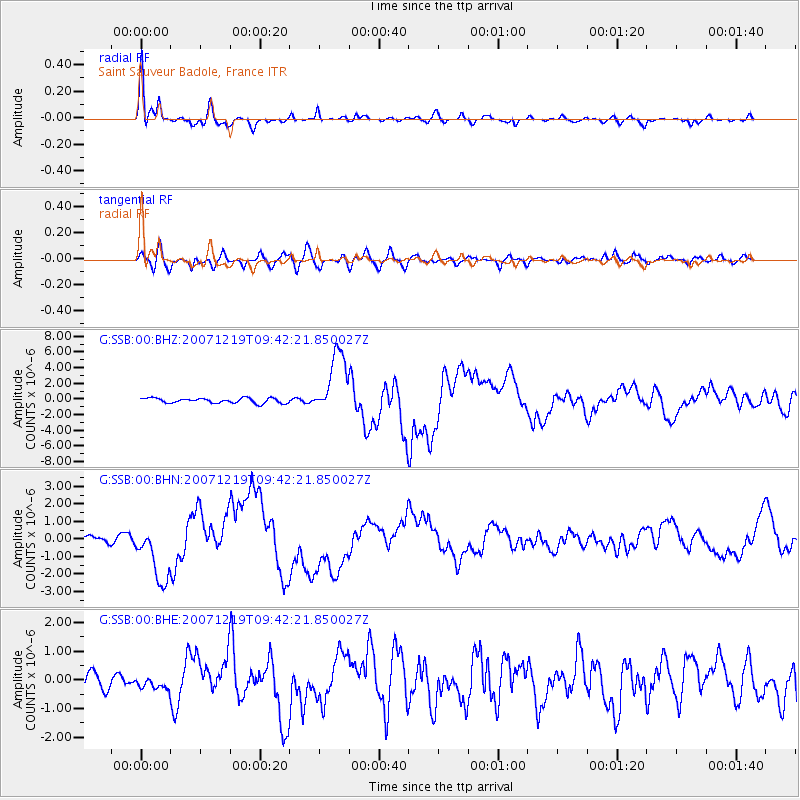
Earthquake location: Andreanof Islands, Aleutian Is.
Earthquake latitude/longitude: 51.4/-179.5
Earthquake time(UTC): 2007/12/19 (353) 09:30:27 GMT
Earthquake Depth: 29 km
Earthquake Magnitude: 6.4 MB, 7.1 MS, 7.1 MW, 7.0 MW
Earthquake Catalog/Contributor: WHDF/NEIC
Network: G GEOSCOPE
Station: SSB Saint Sauveur Badole, France
Lat/Lon: 45.28 N/4.54 E
Elevation: 700 m
Distance: 83.7 deg
Az: 357.114 deg
Baz: 2.562 deg
Ray Param: 0.04598322
Estimated Moho Depth: 27.5 km
Estimated Crust Vp/Vs: 1.66
Assumed Crust Vp: 6.1 km/s
Estimated Crust Vs: 3.675 km/s
Estimated Crust Poisson's Ratio: 0.22
Radial Match: 92.82224 %
Radial Bump: 365
Transverse Match: 68.621735 %
Transverse Bump: 400
SOD ConfigId: 2564
Insert Time: 2010-02-27 00:11:27.000 +0000
GWidth: 2.5
Max Bumps: 400
Tol: 0.001

Signal To Noise

ChannelStoNSTALTA
G:SSB:00:BHN:20071219T09:42:21.850027Z4.13965031.6911405E-64.0852257E-7
G:SSB:00:BHE:20071219T09:42:21.850027Z0.63360242.096111E-73.3082435E-7
G:SSB:00:BHZ:20071219T09:42:21.850027Z12.7968744.079096E-63.187572E-7
Arrivals
Ps3.0 SECOND
PpPs12 SECOND
PsPs/PpSs15 SECOND