You are here: Home > Network List > US - United States National Seismic Network Stations List
> Station HAWA Hanford, Washington, USA > Earthquake Result Viewer
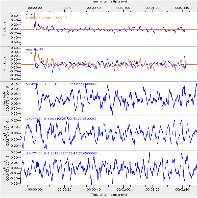
HAWA Hanford, Washington, USA - Earthquake Result Viewer
*The percent match for this event was below the threshold and hence no stack was calculated.
| Earthquake location: |
Near Coast Of Guatemala |
| Earthquake latitude/longitude: |
13.4/-90.9 |
| Earthquake time(UTC): |
2014/05/25 (145) 22:36:19 GMT |
| Earthquake Depth: |
30 km |
| Earthquake Magnitude: |
5.3 MW |
| Earthquake Catalog/Contributor: |
ISC/ISC |
|
| Network: |
US United States National Seismic Network |
| Station: |
HAWA Hanford, Washington, USA |
| Lat/Lon: |
46.39 N/119.53 W |
| Elevation: |
364 m |
|
| Distance: |
40.8 deg |
| Az: |
329.464 deg |
| Baz: |
134.41 deg |
| Ray Param: |
$rayparam |
*The percent match for this event was below the threshold and hence was not used in the summary stack. |
|
| Radial Match: |
62.677937 % |
| Radial Bump: |
400 |
| Transverse Match: |
63.220787 % |
| Transverse Bump: |
400 |
| SOD ConfigId: |
3390531 |
| Insert Time: |
2019-04-12 01:14:25.247 +0000 |
| GWidth: |
2.5 |
| Max Bumps: |
400 |
| Tol: |
0.001 |
|
Signal To Noise
| Channel | StoN | STA | LTA |
| US:HAWA:00:BHZ:20140525T22:43:27.650006Z | 1.7516701 | 1.5350948E-7 | 8.763606E-8 |
| US:HAWA:00:BH1:20140525T22:43:27.650006Z | 0.9622813 | 4.6228482E-8 | 4.804051E-8 |
| US:HAWA:00:BH2:20140525T22:43:27.650006Z | 1.4913704 | 7.3319534E-8 | 4.9162526E-8 |
| Arrivals |
| Ps | |
| PpPs | |
| PsPs/PpSs | |


