SSB Saint Sauveur Badole, France - Earthquake Result Viewer
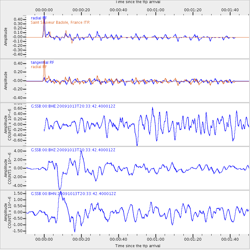
Earthquake location: Fox Islands, Aleutian Islands
Earthquake latitude/longitude: 52.6/-167.1
Earthquake time(UTC): 2009/10/13 (286) 20:21:53 GMT
Earthquake Depth: 14 km
Earthquake Magnitude: 5.9 MB, 6.4 MS, 6.4 MW, 6.4 MW
Earthquake Catalog/Contributor: WHDF/NEIC
Network: G GEOSCOPE
Station: SSB Saint Sauveur Badole, France
Lat/Lon: 45.28 N/4.54 E
Elevation: 700 m
Distance: 82.2 deg
Az: 5.933 deg
Baz: 354.878 deg
Ray Param: 0.04702294
Estimated Moho Depth: 13.25 km
Estimated Crust Vp/Vs: 2.08
Assumed Crust Vp: 6.1 km/s
Estimated Crust Vs: 2.936 km/s
Estimated Crust Poisson's Ratio: 0.35
Radial Match: 91.48974 %
Radial Bump: 390
Transverse Match: 67.88388 %
Transverse Bump: 400
SOD ConfigId: 2622
Insert Time: 2010-02-27 00:11:59.950 +0000
GWidth: 2.5
Max Bumps: 400
Tol: 0.001

Signal To Noise

ChannelStoNSTALTA
G:SSB:00:BHZ:20091013T20:33:42.400012Z6.6661511.0732801E-61.6100448E-7
G:SSB:00:BHN:20091013T20:33:42.400012Z2.45877223.645848E-71.482792E-7
G:SSB:00:BHE:20091013T20:33:42.400012Z1.66822042.222263E-71.332116E-7
Arrivals
Ps2.4 SECOND
PpPs6.6 SECOND
PsPs/PpSs8.9 SECOND