SSB Saint Sauveur Badole, France - Earthquake Result Viewer
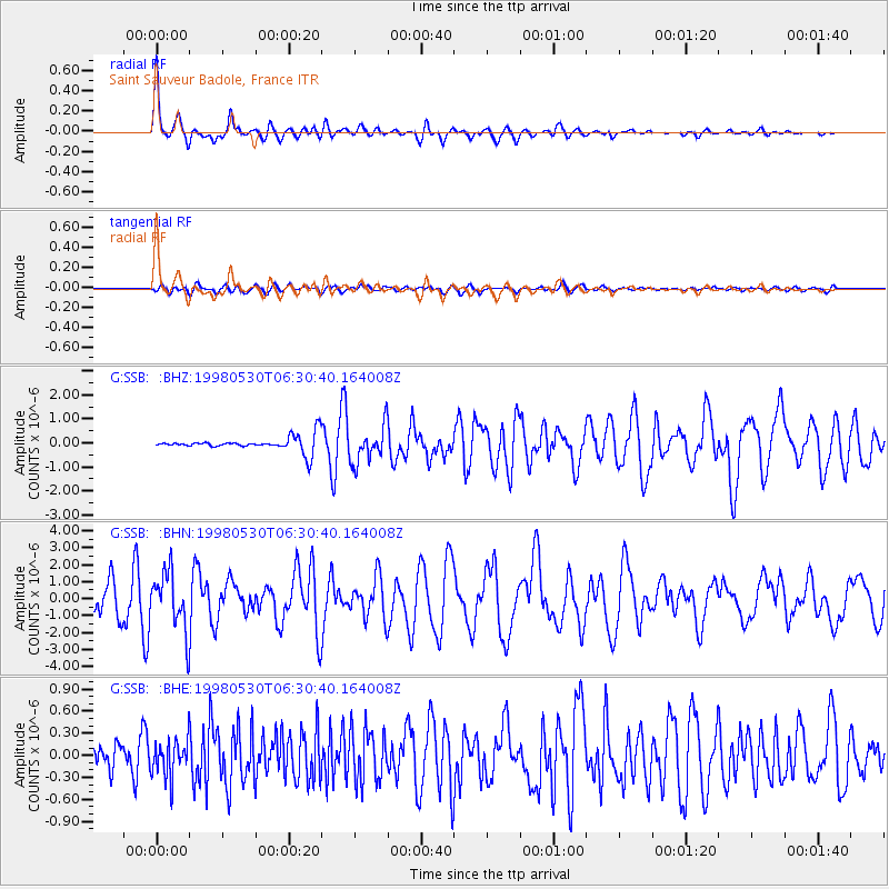
Earthquake location: Afghanistan-Tajikistan Bord Reg.
Earthquake latitude/longitude: 37.1/70.1
Earthquake time(UTC): 1998/05/30 (150) 06:22:28 GMT
Earthquake Depth: 33 km
Earthquake Magnitude: 5.9 MB, 6.9 MS, 6.6 UNKNOWN, 6.5 MW
Earthquake Catalog/Contributor: WHDF/NEIC
Network: G GEOSCOPE
Station: SSB Saint Sauveur Badole, France
Lat/Lon: 45.28 N/4.54 E
Elevation: 700 m
Distance: 48.8 deg
Az: 301.293 deg
Baz: 75.374 deg
Ray Param: 0.06906348
Estimated Moho Depth: 59.25 km
Estimated Crust Vp/Vs: 2.10
Assumed Crust Vp: 6.1 km/s
Estimated Crust Vs: 2.908 km/s
Estimated Crust Poisson's Ratio: 0.35
Radial Match: 94.80585 %
Radial Bump: 393
Transverse Match: 81.28509 %
Transverse Bump: 400
SOD ConfigId: 4480
Insert Time: 2010-02-27 00:12:06.977 +0000
GWidth: 2.5
Max Bumps: 400
Tol: 0.001

Signal To Noise

ChannelStoNSTALTA
G:SSB: :BHN:19980530T06:30:40.164008Z3.43446831.7375087E-65.0590324E-7
G:SSB: :BHE:19980530T06:30:40.164008Z3.16093832.5720053E-78.136841E-8
G:SSB: :BHZ:19980530T06:30:40.164008Z2.51591637.54041E-72.997083E-7
Arrivals
Ps11 SECOND
PpPs29 SECOND
PsPs/PpSs40 SECOND