You are here: Home > Network List > TA - USArray Transportable Network (new EarthScope stations) Stations List
> Station U51A La Follette, TN, USA > Earthquake Result Viewer
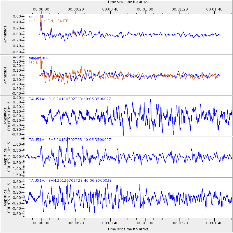
U51A La Follette, TN, USA - Earthquake Result Viewer
*The percent match for this event was below the threshold and hence no stack was calculated.
| Earthquake location: |
Near Coast Of Peru |
| Earthquake latitude/longitude: |
-14.4/-75.6 |
| Earthquake time(UTC): |
2012/07/02 (184) 23:31:37 GMT |
| Earthquake Depth: |
40 km |
| Earthquake Magnitude: |
6.0 MB, 5.2 MS, 5.7 MW, 5.6 MW |
| Earthquake Catalog/Contributor: |
WHDF/NEIC |
|
| Network: |
TA USArray Transportable Network (new EarthScope stations) |
| Station: |
U51A La Follette, TN, USA |
| Lat/Lon: |
36.38 N/84.02 W |
| Elevation: |
472 m |
|
| Distance: |
51.1 deg |
| Az: |
351.274 deg |
| Baz: |
169.505 deg |
| Ray Param: |
$rayparam |
*The percent match for this event was below the threshold and hence was not used in the summary stack. |
|
| Radial Match: |
71.53916 % |
| Radial Bump: |
400 |
| Transverse Match: |
59.411144 % |
| Transverse Bump: |
400 |
| SOD ConfigId: |
463687 |
| Insert Time: |
2013-02-20 18:35:20.481 +0000 |
| GWidth: |
2.5 |
| Max Bumps: |
400 |
| Tol: |
0.001 |
|
Signal To Noise
| Channel | StoN | STA | LTA |
| TA:U51A: :BHZ:20120702T23:40:06.350002Z | 4.8126326 | 4.1577806E-7 | 8.6393065E-8 |
| TA:U51A: :BHN:20120702T23:40:06.350002Z | 2.6607811 | 2.4316702E-7 | 9.138933E-8 |
| TA:U51A: :BHE:20120702T23:40:06.350002Z | 0.7896099 | 6.628905E-8 | 8.395164E-8 |
| Arrivals |
| Ps | |
| PpPs | |
| PsPs/PpSs | |


