You are here: Home > Network List > UW - Pacific Northwest Regional Seismic Network Stations List
> Station MRBL Marblemount, WA, USA > Earthquake Result Viewer
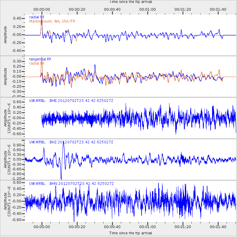
MRBL Marblemount, WA, USA - Earthquake Result Viewer
*The percent match for this event was below the threshold and hence no stack was calculated.
| Earthquake location: |
Near Coast Of Peru |
| Earthquake latitude/longitude: |
-14.4/-75.6 |
| Earthquake time(UTC): |
2012/07/02 (184) 23:31:37 GMT |
| Earthquake Depth: |
40 km |
| Earthquake Magnitude: |
6.0 MB, 5.2 MS, 5.7 MW, 5.6 MW |
| Earthquake Catalog/Contributor: |
WHDF/NEIC |
|
| Network: |
UW Pacific Northwest Regional Seismic Network |
| Station: |
MRBL Marblemount, WA, USA |
| Lat/Lon: |
48.52 N/121.48 W |
| Elevation: |
75 m |
|
| Distance: |
74.7 deg |
| Az: |
330.34 deg |
| Baz: |
133.854 deg |
| Ray Param: |
$rayparam |
*The percent match for this event was below the threshold and hence was not used in the summary stack. |
|
| Radial Match: |
79.02572 % |
| Radial Bump: |
400 |
| Transverse Match: |
79.716644 % |
| Transverse Bump: |
400 |
| SOD ConfigId: |
463687 |
| Insert Time: |
2013-02-20 18:39:47.956 +0000 |
| GWidth: |
2.5 |
| Max Bumps: |
400 |
| Tol: |
0.001 |
|
Signal To Noise
| Channel | StoN | STA | LTA |
| UW:MRBL: :BHZ:20120702T23:42:42.625027Z | 4.1530337 | 2.4836433E-7 | 5.980311E-8 |
| UW:MRBL: :BHN:20120702T23:42:42.625027Z | 1.2490659 | 1.3248051E-7 | 1.06063666E-7 |
| UW:MRBL: :BHE:20120702T23:42:42.625027Z | 0.9729641 | 1.1187838E-7 | 1.1498716E-7 |
| Arrivals |
| Ps | |
| PpPs | |
| PsPs/PpSs | |


