SSB Saint Sauveur Badole, France - Earthquake Result Viewer
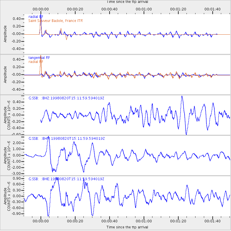
Earthquake location: Rat Islands, Aleutian Islands
Earthquake latitude/longitude: 51.6/175.2
Earthquake time(UTC): 1998/08/20 (232) 15:00:08 GMT
Earthquake Depth: 33 km
Earthquake Magnitude: 5.6 MB, 6.0 MS, 6.2 UNKNOWN, 6.2 MW
Earthquake Catalog/Contributor: WHDF/NEIC
Network: G GEOSCOPE
Station: SSB Saint Sauveur Badole, France
Lat/Lon: 45.28 N/4.54 E
Elevation: 700 m
Distance: 83.1 deg
Az: 353.405 deg
Baz: 5.821 deg
Ray Param: 0.046349384
Estimated Moho Depth: 66.5 km
Estimated Crust Vp/Vs: 2.04
Assumed Crust Vp: 6.1 km/s
Estimated Crust Vs: 2.987 km/s
Estimated Crust Poisson's Ratio: 0.34
Radial Match: 89.63423 %
Radial Bump: 400
Transverse Match: 76.68102 %
Transverse Bump: 400
SOD ConfigId: 4480
Insert Time: 2010-02-27 00:12:23.336 +0000
GWidth: 2.5
Max Bumps: 400
Tol: 0.001

Signal To Noise

ChannelStoNSTALTA
G:SSB: :BHN:19980820T15:11:59.594019Z9.7536511.3548295E-61.3890487E-7
G:SSB: :BHE:19980820T15:11:59.594019Z3.89223744.3022402E-71.1053386E-7
G:SSB: :BHZ:19980820T15:11:59.594019Z1.36666871.111839E-78.135395E-8
Arrivals
Ps12 SECOND
PpPs33 SECOND
PsPs/PpSs44 SECOND