You are here: Home > Network List > G - GEOSCOPE Stations List
> Station MPG Montagne des Peres, French Guyana > Earthquake Result Viewer
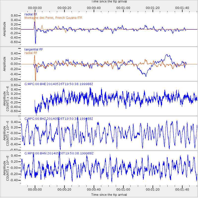
MPG Montagne des Peres, French Guyana - Earthquake Result Viewer
*The percent match for this event was below the threshold and hence no stack was calculated.
| Earthquake location: |
Azores Islands Region |
| Earthquake latitude/longitude: |
42.1/-29.3 |
| Earthquake time(UTC): |
2014/05/26 (146) 19:43:14 GMT |
| Earthquake Depth: |
7.1 km |
| Earthquake Magnitude: |
5.0 MW |
| Earthquake Catalog/Contributor: |
ISC/ISC |
|
| Network: |
G GEOSCOPE |
| Station: |
MPG Montagne des Peres, French Guyana |
| Lat/Lon: |
5.11 N/52.64 W |
| Elevation: |
147 m |
|
| Distance: |
42.3 deg |
| Az: |
215.979 deg |
| Baz: |
26.043 deg |
| Ray Param: |
$rayparam |
*The percent match for this event was below the threshold and hence was not used in the summary stack. |
|
| Radial Match: |
60.05437 % |
| Radial Bump: |
400 |
| Transverse Match: |
46.931324 % |
| Transverse Bump: |
400 |
| SOD ConfigId: |
3390531 |
| Insert Time: |
2019-04-12 01:18:03.498 +0000 |
| GWidth: |
2.5 |
| Max Bumps: |
400 |
| Tol: |
0.001 |
|
Signal To Noise
| Channel | StoN | STA | LTA |
| G:MPG:00:BHZ:20140526T19:50:38.199988Z | 1.247759 | 2.3042607E-7 | 1.8467193E-7 |
| G:MPG:00:BHN:20140526T19:50:38.199988Z | 1.2603087 | 2.6521576E-7 | 2.1043712E-7 |
| G:MPG:00:BHE:20140526T19:50:38.199988Z | 0.97482294 | 2.3431355E-7 | 2.4036524E-7 |
| Arrivals |
| Ps | |
| PpPs | |
| PsPs/PpSs | |


