You are here: Home > Network List > GS - US Geological Survey Networks Stations List
> Station DEC12 Boyd Road Surface Site > Earthquake Result Viewer
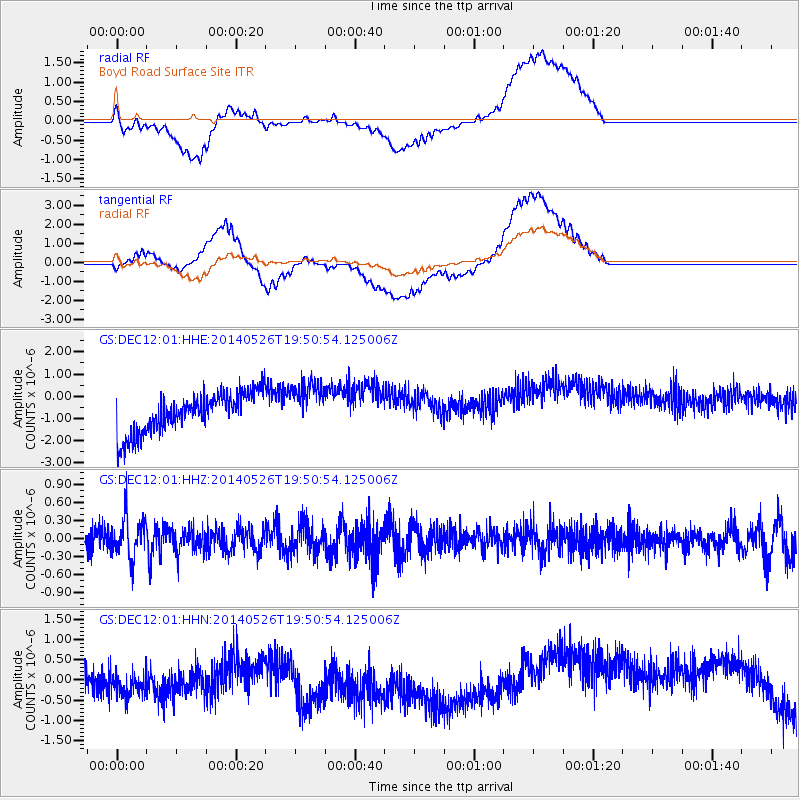
DEC12 Boyd Road Surface Site - Earthquake Result Viewer
*The percent match for this event was below the threshold and hence no stack was calculated.
| Earthquake location: |
Azores Islands Region |
| Earthquake latitude/longitude: |
42.1/-29.3 |
| Earthquake time(UTC): |
2014/05/26 (146) 19:43:14 GMT |
| Earthquake Depth: |
7.1 km |
| Earthquake Magnitude: |
5.0 MW |
| Earthquake Catalog/Contributor: |
ISC/ISC |
|
| Network: |
GS US Geological Survey Networks |
| Station: |
DEC12 Boyd Road Surface Site |
| Lat/Lon: |
39.91 N/88.91 W |
| Elevation: |
208 m |
|
| Distance: |
44.3 deg |
| Az: |
288.037 deg |
| Baz: |
66.955 deg |
| Ray Param: |
$rayparam |
*The percent match for this event was below the threshold and hence was not used in the summary stack. |
|
| Radial Match: |
51.42105 % |
| Radial Bump: |
400 |
| Transverse Match: |
54.274403 % |
| Transverse Bump: |
400 |
| SOD ConfigId: |
3390531 |
| Insert Time: |
2019-04-12 01:18:19.052 +0000 |
| GWidth: |
2.5 |
| Max Bumps: |
400 |
| Tol: |
0.001 |
|
Signal To Noise
| Channel | StoN | STA | LTA |
| GS:DEC12:01:HHZ:20140526T19:50:54.125006Z | 1.8999369 | 3.399129E-7 | 1.7890747E-7 |
| GS:DEC12:01:HHN:20140526T19:50:54.125006Z | 0.75388604 | 7.950108E-7 | 1.0545504E-6 |
| GS:DEC12:01:HHE:20140526T19:50:54.125006Z | 1.2153305 | 1.0823875E-6 | 8.9061166E-7 |
| Arrivals |
| Ps | |
| PpPs | |
| PsPs/PpSs | |


