You are here: Home > Network List > CI - Caltech Regional Seismic Network Stations List
> Station SMM Simmler, CA, USA > Earthquake Result Viewer
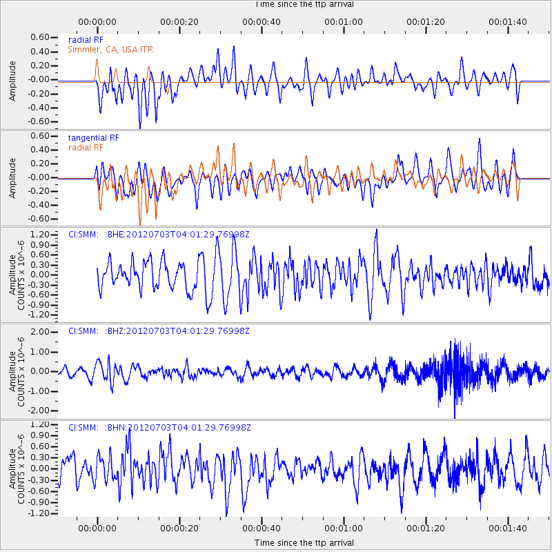
SMM Simmler, CA, USA - Earthquake Result Viewer
*The percent match for this event was below the threshold and hence no stack was calculated.
| Earthquake location: |
Solomon Islands |
| Earthquake latitude/longitude: |
-10.8/163.3 |
| Earthquake time(UTC): |
2012/07/03 (185) 03:49:33 GMT |
| Earthquake Depth: |
92 km |
| Earthquake Magnitude: |
5.6 MB, 5.5 MW, 5.5 MW |
| Earthquake Catalog/Contributor: |
WHDF/NEIC |
|
| Network: |
CI Caltech Regional Seismic Network |
| Station: |
SMM Simmler, CA, USA |
| Lat/Lon: |
35.31 N/120.00 W |
| Elevation: |
599 m |
|
| Distance: |
85.5 deg |
| Az: |
52.961 deg |
| Baz: |
253.518 deg |
| Ray Param: |
$rayparam |
*The percent match for this event was below the threshold and hence was not used in the summary stack. |
|
| Radial Match: |
67.318474 % |
| Radial Bump: |
400 |
| Transverse Match: |
57.103016 % |
| Transverse Bump: |
400 |
| SOD ConfigId: |
463687 |
| Insert Time: |
2013-02-20 18:51:22.439 +0000 |
| GWidth: |
2.5 |
| Max Bumps: |
400 |
| Tol: |
0.001 |
|
Signal To Noise
| Channel | StoN | STA | LTA |
| CI:SMM: :BHZ:20120703T04:01:29.76998Z | 2.2906284 | 5.0119235E-7 | 2.1880125E-7 |
| CI:SMM: :BHN:20120703T04:01:29.76998Z | 0.7187424 | 3.2981112E-7 | 4.5887248E-7 |
| CI:SMM: :BHE:20120703T04:01:29.76998Z | 2.0933876 | 7.8164965E-7 | 3.7338984E-7 |
| Arrivals |
| Ps | |
| PpPs | |
| PsPs/PpSs | |


