You are here: Home > Network List > TA - USArray Transportable Network (new EarthScope stations) Stations List
> Station J01D Myrtle Point, OR, USA > Earthquake Result Viewer
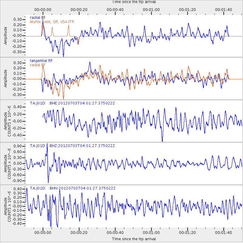
J01D Myrtle Point, OR, USA - Earthquake Result Viewer
*The percent match for this event was below the threshold and hence no stack was calculated.
| Earthquake location: |
Solomon Islands |
| Earthquake latitude/longitude: |
-10.8/163.3 |
| Earthquake time(UTC): |
2012/07/03 (185) 03:49:33 GMT |
| Earthquake Depth: |
92 km |
| Earthquake Magnitude: |
5.6 MB, 5.5 MW, 5.5 MW |
| Earthquake Catalog/Contributor: |
WHDF/NEIC |
|
| Network: |
TA USArray Transportable Network (new EarthScope stations) |
| Station: |
J01D Myrtle Point, OR, USA |
| Lat/Lon: |
43.16 N/123.93 W |
| Elevation: |
131 m |
|
| Distance: |
85.1 deg |
| Az: |
44.537 deg |
| Baz: |
250.34 deg |
| Ray Param: |
$rayparam |
*The percent match for this event was below the threshold and hence was not used in the summary stack. |
|
| Radial Match: |
48.55484 % |
| Radial Bump: |
400 |
| Transverse Match: |
38.71419 % |
| Transverse Bump: |
400 |
| SOD ConfigId: |
463687 |
| Insert Time: |
2013-02-20 18:58:20.746 +0000 |
| GWidth: |
2.5 |
| Max Bumps: |
400 |
| Tol: |
0.001 |
|
Signal To Noise
| Channel | StoN | STA | LTA |
| TA:J01D: :BHZ:20120703T04:01:27.375022Z | 3.4322736 | 4.3978883E-7 | 1.2813338E-7 |
| TA:J01D: :BHN:20120703T04:01:27.375022Z | 1.5876207 | 1.956322E-7 | 1.232235E-7 |
| TA:J01D: :BHE:20120703T04:01:27.375022Z | 1.1718725 | 1.9659461E-7 | 1.677611E-7 |
| Arrivals |
| Ps | |
| PpPs | |
| PsPs/PpSs | |


