You are here: Home > Network List > UW - Pacific Northwest Regional Seismic Network Stations List
> Station FISH Seaside, OR, USA > Earthquake Result Viewer
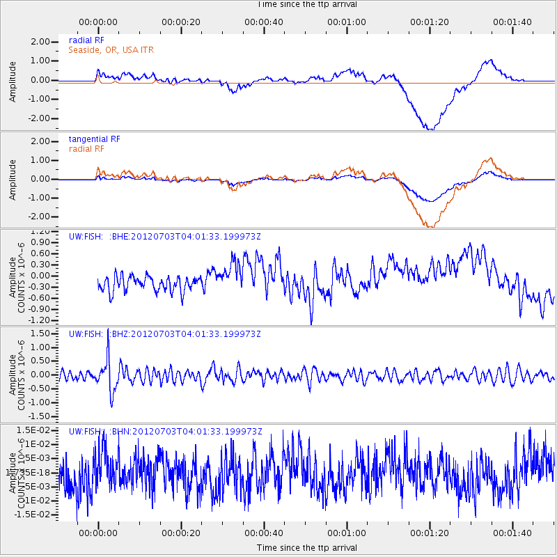
FISH Seaside, OR, USA - Earthquake Result Viewer
*The percent match for this event was below the threshold and hence no stack was calculated.
| Earthquake location: |
Solomon Islands |
| Earthquake latitude/longitude: |
-10.8/163.3 |
| Earthquake time(UTC): |
2012/07/03 (185) 03:49:33 GMT |
| Earthquake Depth: |
92 km |
| Earthquake Magnitude: |
5.6 MB, 5.5 MW, 5.5 MW |
| Earthquake Catalog/Contributor: |
WHDF/NEIC |
|
| Network: |
UW Pacific Northwest Regional Seismic Network |
| Station: |
FISH Seaside, OR, USA |
| Lat/Lon: |
45.93 N/123.56 W |
| Elevation: |
325 m |
|
| Distance: |
86.2 deg |
| Az: |
42.011 deg |
| Baz: |
250.408 deg |
| Ray Param: |
$rayparam |
*The percent match for this event was below the threshold and hence was not used in the summary stack. |
|
| Radial Match: |
56.693737 % |
| Radial Bump: |
400 |
| Transverse Match: |
57.010376 % |
| Transverse Bump: |
400 |
| SOD ConfigId: |
463687 |
| Insert Time: |
2013-02-20 19:00:54.559 +0000 |
| GWidth: |
2.5 |
| Max Bumps: |
400 |
| Tol: |
0.001 |
|
Signal To Noise
| Channel | StoN | STA | LTA |
| UW:FISH: :BHZ:20120703T04:01:33.199973Z | 5.2011414 | 5.9414145E-7 | 1.142329E-7 |
| UW:FISH: :BHN:20120703T04:01:33.199973Z | 1.1676953 | 6.2959895E-9 | 5.3918088E-9 |
| UW:FISH: :BHE:20120703T04:01:33.199973Z | 2.1399577 | 4.2223667E-7 | 1.9731075E-7 |
| Arrivals |
| Ps | |
| PpPs | |
| PsPs/PpSs | |


