You are here: Home > Network List > CI - Caltech Regional Seismic Network Stations List
> Station BFS Mt Baldy Forest Station > Earthquake Result Viewer
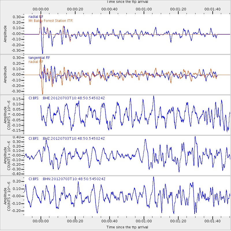
BFS Mt Baldy Forest Station - Earthquake Result Viewer
*The percent match for this event was below the threshold and hence no stack was calculated.
| Earthquake location: |
Cook Strait, New Zealand |
| Earthquake latitude/longitude: |
-40.0/173.8 |
| Earthquake time(UTC): |
2012/07/03 (185) 10:36:15 GMT |
| Earthquake Depth: |
230 km |
| Earthquake Magnitude: |
5.9 MB, 6.3 MW, 6.3 MW |
| Earthquake Catalog/Contributor: |
WHDF/NEIC |
|
| Network: |
CI Caltech Regional Seismic Network |
| Station: |
BFS Mt Baldy Forest Station |
| Lat/Lon: |
34.24 N/117.66 W |
| Elevation: |
1312 m |
|
| Distance: |
97.3 deg |
| Az: |
51.032 deg |
| Baz: |
226.111 deg |
| Ray Param: |
$rayparam |
*The percent match for this event was below the threshold and hence was not used in the summary stack. |
|
| Radial Match: |
50.650063 % |
| Radial Bump: |
400 |
| Transverse Match: |
47.959553 % |
| Transverse Bump: |
400 |
| SOD ConfigId: |
463687 |
| Insert Time: |
2013-02-20 19:07:43.991 +0000 |
| GWidth: |
2.5 |
| Max Bumps: |
400 |
| Tol: |
0.001 |
|
Signal To Noise
| Channel | StoN | STA | LTA |
| CI:BFS: :BHZ:20120703T10:48:50.545024Z | 2.1297803 | 1.7789178E-7 | 8.352589E-8 |
| CI:BFS: :BHN:20120703T10:48:50.545024Z | 1.1566255 | 6.8949355E-8 | 5.961252E-8 |
| CI:BFS: :BHE:20120703T10:48:50.545024Z | 0.6321542 | 4.235854E-8 | 6.700665E-8 |
| Arrivals |
| Ps | |
| PpPs | |
| PsPs/PpSs | |


