You are here: Home > Network List > TA - USArray Transportable Network (new EarthScope stations) Stations List
> Station J01E Myrtle Point, OR, USA > Earthquake Result Viewer
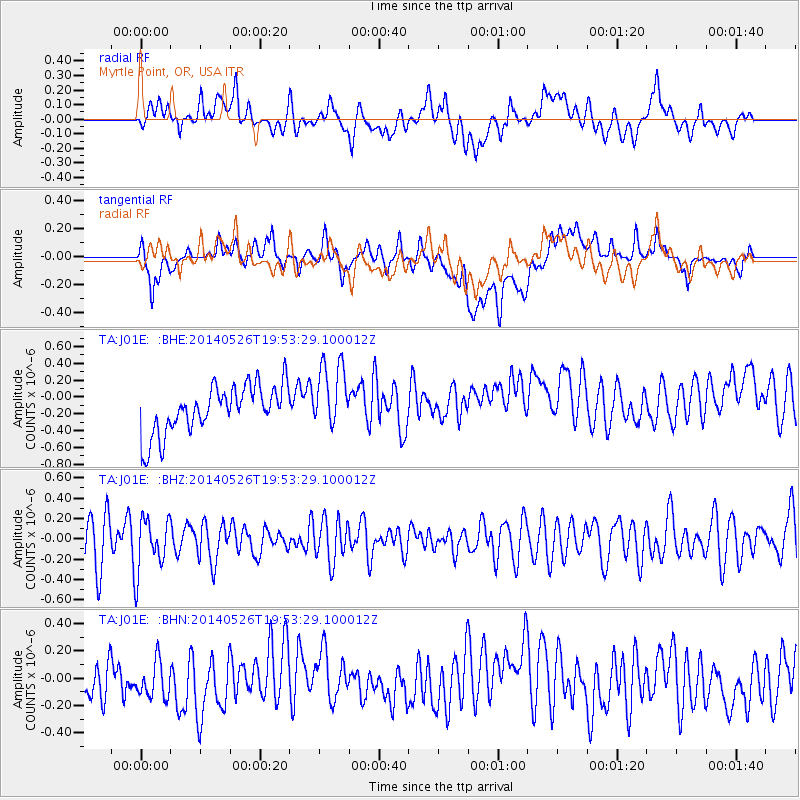
J01E Myrtle Point, OR, USA - Earthquake Result Viewer
*The percent match for this event was below the threshold and hence no stack was calculated.
| Earthquake location: |
Azores Islands Region |
| Earthquake latitude/longitude: |
42.1/-29.3 |
| Earthquake time(UTC): |
2014/05/26 (146) 19:43:14 GMT |
| Earthquake Depth: |
7.1 km |
| Earthquake Magnitude: |
5.0 MW |
| Earthquake Catalog/Contributor: |
ISC/ISC |
|
| Network: |
TA USArray Transportable Network (new EarthScope stations) |
| Station: |
J01E Myrtle Point, OR, USA |
| Lat/Lon: |
43.16 N/123.93 W |
| Elevation: |
128 m |
|
| Distance: |
65.7 deg |
| Az: |
306.882 deg |
| Baz: |
54.463 deg |
| Ray Param: |
$rayparam |
*The percent match for this event was below the threshold and hence was not used in the summary stack. |
|
| Radial Match: |
41.72747 % |
| Radial Bump: |
400 |
| Transverse Match: |
44.26873 % |
| Transverse Bump: |
400 |
| SOD ConfigId: |
3390531 |
| Insert Time: |
2019-04-12 01:21:55.449 +0000 |
| GWidth: |
2.5 |
| Max Bumps: |
400 |
| Tol: |
0.001 |
|
Signal To Noise
| Channel | StoN | STA | LTA |
| TA:J01E: :BHZ:20140526T19:53:29.100012Z | 0.8752529 | 2.605801E-7 | 2.9771977E-7 |
| TA:J01E: :BHN:20140526T19:53:29.100012Z | 0.83299565 | 1.6314274E-7 | 1.9585065E-7 |
| TA:J01E: :BHE:20140526T19:53:29.100012Z | 1.3946152 | 3.956994E-7 | 2.8373375E-7 |
| Arrivals |
| Ps | |
| PpPs | |
| PsPs/PpSs | |


