You are here: Home > Network List > TA - USArray Transportable Network (new EarthScope stations) Stations List
> Station M53A WI Miller and Sons, Farmdale, OH, USA > Earthquake Result Viewer
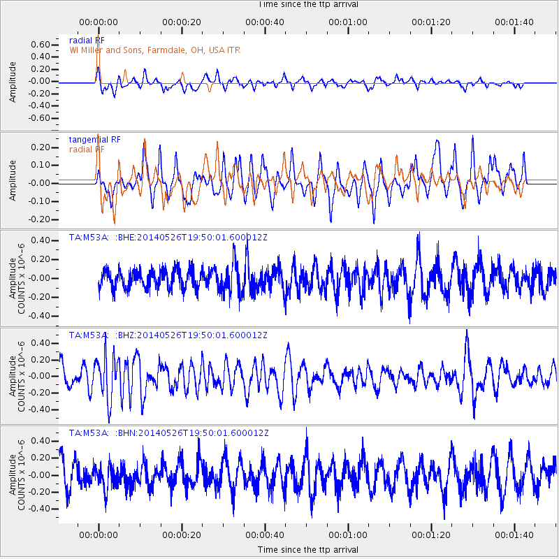
M53A WI Miller and Sons, Farmdale, OH, USA - Earthquake Result Viewer
*The percent match for this event was below the threshold and hence no stack was calculated.
| Earthquake location: |
Azores Islands Region |
| Earthquake latitude/longitude: |
42.1/-29.3 |
| Earthquake time(UTC): |
2014/05/26 (146) 19:43:14 GMT |
| Earthquake Depth: |
7.1 km |
| Earthquake Magnitude: |
5.0 MW |
| Earthquake Catalog/Contributor: |
ISC/ISC |
|
| Network: |
TA USArray Transportable Network (new EarthScope stations) |
| Station: |
M53A WI Miller and Sons, Farmdale, OH, USA |
| Lat/Lon: |
41.44 N/80.68 W |
| Elevation: |
334 m |
|
| Distance: |
37.9 deg |
| Az: |
286.824 deg |
| Baz: |
71.389 deg |
| Ray Param: |
$rayparam |
*The percent match for this event was below the threshold and hence was not used in the summary stack. |
|
| Radial Match: |
67.46499 % |
| Radial Bump: |
390 |
| Transverse Match: |
62.76995 % |
| Transverse Bump: |
383 |
| SOD ConfigId: |
3390531 |
| Insert Time: |
2019-04-12 01:22:16.519 +0000 |
| GWidth: |
2.5 |
| Max Bumps: |
400 |
| Tol: |
0.001 |
|
Signal To Noise
| Channel | StoN | STA | LTA |
| TA:M53A: :BHZ:20140526T19:50:01.600012Z | 2.4831321 | 2.6598804E-7 | 1.0711796E-7 |
| TA:M53A: :BHN:20140526T19:50:01.600012Z | 0.9892542 | 1.4003001E-7 | 1.4155108E-7 |
| TA:M53A: :BHE:20140526T19:50:01.600012Z | 1.7506336 | 1.6910481E-7 | 9.6596345E-8 |
| Arrivals |
| Ps | |
| PpPs | |
| PsPs/PpSs | |


